| BUTLER COUNTY/K W SCHOLTER FLD BUTLER PA |
| |
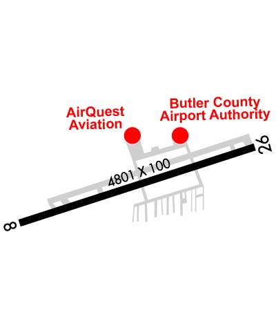
| Lat: N 4046.6 Long: W 07957.1 Elev: 1248 Var: +08 Longest Runway: 4801 | ||
| Clr Del: 119.4 AWOS: 121.45 CTAF: 123.05 | ||
| ||||||||||||||||||||||||||||||||||||||||||||||||||||||||||||||||||||
| ||||||||||||||||||||||||||||||||||||||||||||||||||||||||||||||||||||
| ||||||||||||||||||||||||||||||||||||||||||||||||||||||||||||||||||||
| ||||||||||||||||||||||||||||||||||||||||||||||||||||||||||||||||||||
| Rwy | Rwy | |||||||
| 4801x100 | 4801' | 111.50 - 080° | 4801x100 | 4801' | ||||
| Runway ID | Single Wheel | Double Wheel | Double Tandem Wheel | Dual Double Wheel |
| 08/26 | 37,000 | 50,000 | N/A | N/A |
| These numbers are Advisory and are not limits. The Airport Manager should have more accurate Weight Limits | ||||
 Airport Diagram might not be current. | |
| Facility Name: | PITTSBURGH/BUTLER RGNL |
| City Name: | BUTLER |
| County: | BUTLER |
| State abbrev: | PA |
| State Name: | PENNSYLVANIA |
| Ownership: | PUBLICLY OWNED |
| Use: | OPEN TO THE PUBLIC |
| Owner's Name: | BUTLER CO ARPT AUTH |
| Address: | 473 AIRPORT RD, SUITE 2 |
| BUTLER, PA 16002 | |
| Owner's Phone: | 724-586-6665 |
| Manager's Name: | IKE KELLY |
| Address: | 473 AIRPORT RD, SUITE 2 |
| BUTLER, PA 16002 | |
| Phone: | 724-586-6665 |
| FAA Region: | EASTERN |
| FAA Field Office: | HAR |

| Date | Sunrise | Sunset |
|---|---|---|
| 09/24/21 Friday | 7:09 | 19:14 |
| 09/25/21 Saturday | 7:10 | 19:12 |
| 09/26/21 Sunday | 7:11 | 19:11 |
| 09/27/21 Monday | 7:12 | 19:09 |
| 09/28/21 Tuesday | 7:13 | 19:07 |
| 09/29/21 Wednesday | 7:14 | 19:06 |
| 09/30/21 Thursday | 7:15 | 19:04 |
| 10/01/21 Friday | 7:16 | 19:02 |
| 10/02/21 Saturday | 7:17 | 19:01 |
| 10/03/21 Sunday | 7:18 | 18:59 |
| 10/04/21 Monday | 7:19 | 18:57 |
| 10/05/21 Tuesday | 7:20 | 18:56 |
| 10/06/21 Wednesday | 7:21 | 18:54 |
| 10/07/21 Thursday | 7:22 | 18:52 |
| Airport Attendance Schedule | MON-FRI 0700-1900, SAT-SUN 0800-1800; UNATNDD CHRISTMAS DAY AND EASTER DAY. |
| Airport Status | OPERATIONAL (This Status can change at any time - please check NOTAMS) |
| Airport Lighting Schedule | ACTVT MALSF RWY 08; PAPI RWY 08 & 26; HIRL RWY 08/26 - CTAF. |
| Airport Storage Available | Tie Downs, Hanger |
| Extra Services Available | Air Freight, Air Ambulance, Avionics, Cargo Handling, Charter, Flight Instruction, Aircraft Rental, Aircraft Sales |
| Wind Indicator | YES - (lighted) |
| Control Tower | NO |
| CTAF Frequency | 123.050 |
| Unicom Frequency | 123.050 |
| Rotating Beacon Color | CLEAR-GREEN (Light Land Airport) |
| Segmented Circle | YES |
| Landing Fee |
| Airport Inspected | STATE - performed by STATE AERONAUTICAL PERSONNEL |
| Inspection Date | 06/15/2020 |
| Type of Fuel Available | Grade 100LL, JET A (freeze point -40C), JET A; -10100LL SELF-SERVE AVBL. |
| Airframe Repair Service | MAJOR |
| Power Plant Repair Service | MAJOR |
| Latitude | N4046.6 |
| Longitude | W07957.1 (ESTIMATED) |
| Arpt Elevation | 1248ft (SURVEYED) |
| Magnetic Variation | 08W |
| 5 miles SW | of BUTLER |
| Traffic Pattern Altitude | |
| Sectional Chart | DETROIT |
| Operations (Reported) | Yearly | Avg. Daily |
|---|---|---|
| General Aviation Transient | 12623 | 35 |
| General Aviation Local | 60375 | 165 |
| Air Taxi | 1328 | 4 |
| Commerical | 0 | 0 |
| Commuter | 0 | 0 |
| Military | 60 | 0 |
| Aircraft based on Field | |
|---|---|
| General Aviation Singles | 108 |
| General Aviation Multi | 6 |
| Jet Aircraft | 12 |
| General Aviation Helicopters | 3 |
| Military Aircraft | 0 |
| Gliders | 1 |
| Ultralights | 0 |
| FSS on field | NO |
| FSS tie-in | ALTOONA |
| FSS Phone | 1-800-WX-BRIEF |
| Who issues Notams | BTP |
| Notam D service at airport | YES |
| ARTCC Name | CLEVELAND |
| Airport Certification | |
| Aircraft Rescue & Firefighting Index | None |
| Airport of Entry | No |
| Custom Landing Rights | No |
| Joint Civil/Military | No |
| Military Landing rights | YES |
| NATIONAL PLAN OF INTEGRATED AIRPORT SYSTEMS (NPIAS) |
| GRANT AGREEMENTS UNDER FAAP/ADAP/AIP |
| ASSURANCES PURSUANT TO TITLE VI, CIVIL RIGHTS ACT OF 1964 |
| THIS AIRPORT HAS BEEN SURVEYED BY THE NATIONAL GEODETIC SURVEY. |
| NOISE ABATEMENT PROC IN EFCT; CMB TO 2000 FT BFR TURNING. |
| DEER AND BIRDS ON AND INVOF ARPT. |
| ARPT OFC HRS 0800-1630 M-F, CLSD HOLS. |
Airport Communications & Frequencies:
| |||||||||||||||||||||||
| Runway: 08 | Runway: 26 | ||
| Mag heading: | 80° | Mag heading: | 260° |
| Rwy Slope: | .32% Up | Rwy Slope: | -.32% Down |
| Approach: | ILS | Approach: | |
| Pattern: | Left Traffic | Pattern: | Left Traffic |
| Markings: | PRECISION INSTRUMENT | Markings: | NONPRECISION INSTRUMENT |
| Marking Condition: | GOOD | Marking Condition: | GOOD |
| Arresting Dev: | Arresting Dev: | ||
| Lat & Long: | N4046.5 W07957.6 | Lat. & Long.: | N4046.7 W07956.6 |
| Elev: | 1227.7 ft. MSL | Elev: | 1243.2 ft. MSL |
| TCH: | 53 ft. AGL | TCH: | 52 ft. AGL |
| Visual Glide Path: | 3.00 degrees | Visual Glide Path: | 3.50 degrees |
| Displaced Threshold: | No | Displaced Threshold: | No |
| Touchdown Zone: | YES | Touchdown Zone: | YES |
| Touchdown Elev.: | 1246.5 feet | Touchdown Elev.: | 1248.4 feet |
| Visual Glide Slope: | 4-Light PAPI on LEFT side of Runway | Visual Glide Slope: | 4-Light PAPI on LEFT side of Runway |
| RVR Equipment: | RVR Equipment: | ||
| RVV Equipment: | NO | RVV Equipment: | NO |
| Approach Lights: | MALSF - 1,400 foot medium intensity approach lighting system with sequenced flashers | Approach Lights: | |
| REIL: | NO | REIL: | YES |
| Centerline Lights: | NO | Centerline Lights: | NO |
| Touchdown lights: | NO | Touchdown lights: | NO |
| Runway Category: | Precision Instrument Runway | Runway Category: | Runway with a Non-precision Approach having visibility minimums greater than 3/4 mile |
| Declared Distances: | Declared Distances: | ||
| Obstructions: | TREES | Obstructions: | TREES |
| Marked: | NOT Marked/Lighted | Marked: | NOT Marked/Lighted |
| Clearance slope: | 17:1 | Clearance slope: | 19:1 |
| Obstruction height: | 44 feet AGL | Obstruction height: | 31 feet AGL |
| Dist. from runway: | 957 feet | Dist. from runway: | 819 feet |
| Centerline offset: | 574 right of centerline | Centerline offset: | 11 feet left of centerline |
| Comments: | RWY 08 5 FT BRUSH 93 FT FM THR 129 FT RIGHT. | Comments: | RWY 26 PUB ROAD AT THR 455 FT RIGHT. |
Thanks for using FltPlan.com
all rights reserved © 1999-2021 by Flight Plan LLC