
| PIERCE COUNTY - THUN FIELD PUYALLUP WA |
| |
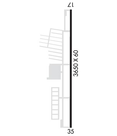
| Lat: N 4706.2 Long: W 12217.2 Elev: 538 Var: -15 Longest Runway: 3651 | ||
| Clr Del: 121.85 AWOS: 128.57 CTAF: 122.7 | ||
| |||||||||||||||||||||||||||||||||||||||||||||||||||||||||||||
| |||||||||||||||||||||||||||||||||||||||||||||||||||||||||||||
| |||||||||||||||||||||||||||||||||||||||||||||||||||||||||||||
| |||||||||||||||||||||||||||||||||||||||||||||||||||||||||||||
| |||||||||||||||||||||||||||||||||||||||||||||||||||||||||||||
| Rwy | Rwy | |||||||
| 3651x60 | 3651' | 3651x60 | 3651' | |||||
| Runway ID | Single Wheel | Double Wheel | Double Tandem Wheel | Dual Double Wheel |
| 17/35 | N/A | N/A | N/A | N/A |
| These numbers are Advisory and are not limits. The Airport Manager should have more accurate Weight Limits | ||||
 Airport Diagram might not be current. | |
| Facility Name: | PIERCE COUNTY/THUN FLD |
| City Name: | PUYALLUP |
| County: | PIERCE |
| State abbrev: | WA |
| State Name: | WASHINGTON |
| Ownership: | PUBLICLY OWNED |
| Use: | OPEN TO THE PUBLIC |
| Owner's Name: | PIERCE COUNTY |
| Address: | 9850 - 64TH ST. W. |
| UNIVERSITY PLACE, WA 98467 | |
| Owner's Phone: | 253-798-2421 |
| Manager's Name: | ROD PROPST |
| Address: | 16915 103RD AVE E |
| PUYALLUP, WA 98374-3768 | |
| Phone: | 253-798-3779 |
| FAA Region: | NORTHWEST MOUNTAIN |
| FAA Field Office: | SEA |
| Date | Sunrise | Sunset |
|---|---|---|
| 02/10/25 Monday | 7:22 | 17:26 |
| 02/11/25 Tuesday | 7:21 | 17:27 |
| 02/12/25 Wednesday | 7:19 | 17:29 |
| 02/13/25 Thursday | 7:17 | 17:30 |
| 02/14/25 Friday | 7:16 | 17:32 |
| 02/15/25 Saturday | 7:14 | 17:33 |
| 02/16/25 Sunday | 7:13 | 17:35 |
| 02/17/25 Monday | 7:11 | 17:36 |
| 02/18/25 Tuesday | 7:09 | 17:38 |
| 02/19/25 Wednesday | 7:07 | 17:39 |
| 02/20/25 Thursday | 7:06 | 17:41 |
| 02/21/25 Friday | 7:04 | 17:42 |
| 02/22/25 Saturday | 7:02 | 17:44 |
| 02/23/25 Sunday | 7:00 | 17:46 |
| Airport Attendance Schedule | 7 Days A Week 0800-1400 |
| Airport Status | OPERATIONAL (This Status can change at any time - please check NOTAMS) |
| Airport Lighting Schedule | ACTVT REIL RWYS 17 & 35; PAPI RWYS 17 & 35 AND MIRL RWY 17/35 -CTAF. |
| Airport Storage Available | Tie Downs |
| Extra Services Available | Avionics, Flight Instruction, Aircraft Rental |
| Wind Indicator | YES - (lighted) |
| Control Tower | NO |
| CTAF Frequency | 122.700 |
| Unicom Frequency | 122.700 |
| Rotating Beacon Color | WG |
| Segmented Circle | YES |
| Landing Fee | NO |
| Airport Inspected | STATE - performed by STATE AERONAUTICAL PERSONNEL |
| Inspection Date | 06/12/2023 |
| Type of Fuel Available | Grade 100LL; -10FUEL AVBL 24 HOURS WITH CREDIT CARD. |
| Airframe Repair Service | MAJOR |
| Power Plant Repair Service | MAJOR |
| Latitude | N4706.2 |
| Longitude | W12217.2 (ESTIMATED) |
| Arpt Elevation | 537ft (SURVEYED) |
| Magnetic Variation | 15E |
| 5 miles S | of PUYALLUP |
| Traffic Pattern Altitude | |
| Sectional Chart | SEATTLE |
| Operations (Reported) | Yearly | Avg. Daily |
|---|---|---|
| General Aviation Transient | 0 | 0 |
| General Aviation Local | 0 | 0 |
| Air Taxi | 0 | 0 |
| Commerical | 0 | 0 |
| Commuter | 0 | 0 |
| Military | 0 | 0 |
| Aircraft based on Field | |
|---|---|
| General Aviation Singles | 0 |
| General Aviation Multi | 0 |
| Jet Aircraft | 0 |
| General Aviation Helicopters | 0 |
| Military Aircraft | 0 |
| Gliders | 0 |
| Ultralights | 0 |
| FSS on field | NO |
| FSS tie-in | SEATTLE |
| FSS Phone | 1-800-WX-BRIEF |
| Who issues Notams | PLU |
| Notam D service at airport | YES |
| ARTCC Name | SEATTLE |
| Airport Certification | |
| Aircraft Rescue & Firefighting Index | None |
| Airport of Entry | No |
| Custom Landing Rights | No |
| Joint Civil/Military | No |
| Military Landing rights | YES |
| NATIONAL PLAN OF INTEGRATED AIRPORT SYSTEMS (NPIAS) |
| GRANT AGREEMENTS UNDER FAAP/ADAP/AIP |
| ASSURANCES PURSUANT TO TITLE VI, CIVIL RIGHTS ACT OF 1964 |
| ULTRALIGHTS PROHIBITED. |
| NOISE SENSITIVE ALL QUADRANTS. |
| FOR CD CTC SEATTLE APCH AT 206-214-4723. |
Airport Communications & Frequencies:
| ||||||||||||||||
| Runway: 17 | Runway: 35 | ||
| Mag heading: | 165° | Mag heading: | 345° |
| Rwy Slope: | -.05% Down | Rwy Slope: | .05% Up |
| Approach: | Approach: | ||
| Pattern: | Left Traffic | Pattern: | Left Traffic |
| Markings: | NONPRECISION INSTRUMENT | Markings: | NONPRECISION INSTRUMENT |
| Marking Condition: | GOOD | Marking Condition: | GOOD |
| Arresting Dev: | Arresting Dev: | ||
| Lat & Long: | N4706.5 W12217.2 | Lat. & Long.: | N4705.9 W12217.2 |
| Elev: | 537.4 ft. MSL | Elev: | 535.4 ft. MSL |
| TCH: | 53 ft. AGL | TCH: | 53 ft. AGL |
| Visual Glide Path: | 4.00 degrees | Visual Glide Path: | 4.00 degrees |
| Displaced Threshold: | No | Displaced Threshold: | No |
| Touchdown Zone: | YES | Touchdown Zone: | YES |
| Touchdown Elev.: | 537.6 feet | Touchdown Elev.: | 537.6 feet |
| Visual Glide Slope: | 4-Light PAPI on LEFT side of Runway | Visual Glide Slope: | 4-Light PAPI on RIGHT side of Runway |
| RVR Equipment: | RVR Equipment: | ||
| RVV Equipment: | NO | RVV Equipment: | NO |
| Approach Lights: | Approach Lights: | ||
| REIL: | YES | REIL: | YES |
| Centerline Lights: | NO | Centerline Lights: | NO |
| Touchdown lights: | NO | Touchdown lights: | NO |
| Runway Category: | Runway with a Visual Approach | Runway Category: | Runway with a Non-precision Approach |
| Declared Distances: | Declared Distances: | ||
| Obstructions: | TREES | Obstructions: | ROAD |
| Marked: | NOT Marked/Lighted | Marked: | NOT Marked/Lighted |
| Clearance slope: | 34:1 | Clearance slope: | 3:1 |
| Obstruction height: | 75 feet AGL | Obstruction height: | 13 feet AGL |
| Dist. from runway: | 2800 feet | Dist. from runway: | 242 feet |
| Centerline offset: | Centerline offset: | B | |
| Comments: | Comments: |
Thanks for using FltPlan.com
all rights reserved © 1999-2025 by Flight Plan LLC

