
| PERRY-HOUSTON COUNTY PERRY GA |
| |
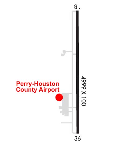
| Lat: N 3230.6 Long: W 08346.0 Elev: 418 Var: +06 Longest Runway: 5004 | ||
| AWOS: 123.82 CTAF: 122.72 | ||
| |||||||||||||||||||||||||||||||||||||||||||||||||||||||||||||||||||||
| |||||||||||||||||||||||||||||||||||||||||||||||||||||||||||||||||||||
| |||||||||||||||||||||||||||||||||||||||||||||||||||||||||||||||||||||
| Rwy | Rwy | |||||||
| 5004x100 | 5004' | 5004x100 | 5004' | 109.15 - 005° | ||||
| Runway ID | Single Wheel | Double Wheel | Double Tandem Wheel | Dual Double Wheel |
| 18/36 | 40,000 | 91,000 | 145,000 | N/A |
| These numbers are Advisory and are not limits. The Airport Manager should have more accurate Weight Limits | ||||
 Airport Diagram might not be current. | |
| Facility Name: | PERRY-HOUSTON COUNTY |
| City Name: | PERRY |
| County: | HOUSTON |
| State abbrev: | GA |
| State Name: | GEORGIA |
| Ownership: | PUBLICLY OWNED |
| Use: | OPEN TO THE PUBLIC |
| Owner's Name: | PERRY-HOUSTON CO ARPT AUTH; BILL JERLES, CHAIRMAN AIRPORT AUTHORITY. |
| Address: | 375 MYRTLE FIELD ROAD |
| PERRY, GA 31069 | |
| Owner's Phone: | 478-988-3699 |
| Manager's Name: | JIM MARQUARDT |
| Address: | 375 MYRTLE FIELD ROAD |
| PERRY, GA 31069 | |
| Phone: | 478-988-3699 |
| FAA Region: | SOUTHERN |
| FAA Field Office: | ATL |
| Date | Sunrise | Sunset |
|---|---|---|
| 03/30/25 Sunday | 7:26 | 19:54 |
| 03/31/25 Monday | 7:25 | 19:54 |
| 04/01/25 Tuesday | 7:24 | 19:55 |
| 04/02/25 Wednesday | 7:22 | 19:56 |
| 04/03/25 Thursday | 7:21 | 19:56 |
| 04/04/25 Friday | 7:20 | 19:57 |
| 04/05/25 Saturday | 7:18 | 19:58 |
| 04/06/25 Sunday | 7:17 | 19:58 |
| 04/07/25 Monday | 7:16 | 19:59 |
| 04/08/25 Tuesday | 7:15 | 20:00 |
| 04/09/25 Wednesday | 7:13 | 20:01 |
| 04/10/25 Thursday | 7:12 | 20:01 |
| 04/11/25 Friday | 7:11 | 20:02 |
| 04/12/25 Saturday | 7:10 | 20:03 |
| Airport Attendance Schedule | 7 Days A Week 0800-1800; CLSD THANKSGIVING, CHRISTMAS, NEW YEARS AND EASTER. |
| Airport Status | OPERATIONAL (This Status can change at any time - please check NOTAMS) |
| Airport Lighting Schedule | ACTVT MALSR RWY 36; PAPI RWY 18 & 36; HIRL RWY 18/36 - CTAF. |
| Airport Storage Available | Tie Downs, Hanger |
| Extra Services Available | Flight Instruction, Aircraft Rental |
| Wind Indicator | YES - (lighted) |
| Control Tower | NO |
| CTAF Frequency | 122.725 |
| Unicom Frequency | 122.725 |
| Rotating Beacon Color | WG |
| Segmented Circle | YES |
| Landing Fee | NO |
| Airport Inspected | STATE - performed by STATE AERONAUTICAL PERSONNEL |
| Inspection Date | 04/17/2024 |
| Type of Fuel Available | Grade 100LL, JET A |
| Airframe Repair Service | MAJOR |
| Power Plant Repair Service | MAJOR |
| Latitude | N3230.6 |
| Longitude | W08346.0 (ESTIMATED) |
| Arpt Elevation | 418ft (SURVEYED) |
| Magnetic Variation | 06W |
| 4 miles NW | of PERRY |
| Traffic Pattern Altitude | |
| Sectional Chart | ATLANTA |
| Operations (Reported) | Yearly | Avg. Daily |
|---|---|---|
| General Aviation Transient | 0 | 0 |
| General Aviation Local | 0 | 0 |
| Air Taxi | 0 | 0 |
| Commerical | 0 | 0 |
| Commuter | 0 | 0 |
| Military | 0 | 0 |
| Aircraft based on Field | |
|---|---|
| General Aviation Singles | 0 |
| General Aviation Multi | 0 |
| Jet Aircraft | 0 |
| General Aviation Helicopters | 0 |
| Military Aircraft | 0 |
| Gliders | 0 |
| Ultralights | 0 |
| FSS on field | NO |
| FSS tie-in | MACON |
| FSS Phone | 1-800-WX-BRIEF |
| Who issues Notams | MCN |
| Notam D service at airport | YES |
| ARTCC Name | ATLANTA |
| Airport Certification | |
| Aircraft Rescue & Firefighting Index | None |
| Airport of Entry | No |
| Custom Landing Rights | No |
| Joint Civil/Military | No |
| Military Landing rights | YES |
| NATIONAL PLAN OF INTEGRATED AIRPORT SYSTEMS (NPIAS) |
| GRANT AGREEMENTS UNDER FAAP/ADAP/AIP |
| SURPLUS PROPERTY AGREEMENT UNDER REGULATION 16-WAA |
| ASSURANCES PURSUANT TO TITLE VI, CIVIL RIGHTS ACT OF 1964 |
| FOR CD CTC ATLANTA APCH AT 678-364-6132, WHEN APCH CLSD CTC ATLANTA ARTCC AT 770-210-7692. |
Airport Communications & Frequencies:
| |||||||||||||||||||||
| Runway: 18 | Runway: 36 | ||
| Mag heading: | 185° | Mag heading: | 5° |
| Rwy Slope: | -.14% Down | Rwy Slope: | .14% Up |
| Approach: | Approach: | LOC/GS | |
| Pattern: | Left Traffic | Pattern: | Left Traffic |
| Markings: | NONPRECISION INSTRUMENT | Markings: | PRECISION INSTRUMENT |
| Marking Condition: | GOOD | Marking Condition: | GOOD |
| Arresting Dev: | Arresting Dev: | ||
| Lat & Long: | N3231.0 W08346.0 | Lat. & Long.: | N3230.2 W08346.0 |
| Elev: | 418.0 ft. MSL | Elev: | 410.8 ft. MSL |
| TCH: | 30 ft. AGL | TCH: | 30 ft. AGL |
| Visual Glide Path: | 3.00 degrees | Visual Glide Path: | 3.00 degrees |
| Displaced Threshold: | No | Displaced Threshold: | No |
| Touchdown Zone: | YES | Touchdown Zone: | YES |
| Touchdown Elev.: | 418.2 feet | Touchdown Elev.: | 417.2 feet |
| Visual Glide Slope: | 2-Light PAPI on LEFT side of Runway | Visual Glide Slope: | 2-Light PAPI on LEFT side of Runway |
| RVR Equipment: | RVR Equipment: | ||
| RVV Equipment: | NO | RVV Equipment: | NO |
| Approach Lights: | Approach Lights: | MALSR - 1,400 foot medium intensity approach lighting system with runway alignment indicator lights | |
| REIL: | NO | REIL: | NO |
| Centerline Lights: | NO | Centerline Lights: | NO |
| Touchdown lights: | NO | Touchdown lights: | NO |
| Runway Category: | D | Runway Category: | Precision Instrument Runway |
| Declared Distances: | Declared Distances: | ||
| Obstructions: | TREES | Obstructions: | TREES |
| Marked: | NOT Marked/Lighted | Marked: | NOT Marked/Lighted |
| Clearance slope: | 26:1 | Clearance slope: | 39:1 |
| Obstruction height: | 59 feet AGL | Obstruction height: | 56 feet AGL |
| Dist. from runway: | 1734 feet | Dist. from runway: | 2384 feet |
| Centerline offset: | 656 right of centerline | Centerline offset: | 713 feet left of centerline |
| Comments: | Comments: |
Thanks for using FltPlan.com
all rights reserved © 1999-2025 by Flight Plan LLC


