
| DAWSON CITY DAWSON CITY YT |
| |
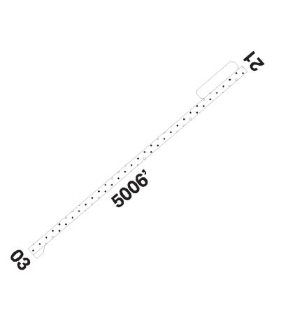
| Lat: N 6402.5 Long: W 13907.8 Elev: 1215 Var: -26 Longest Runway: 5003 | ||
| CTAF: 122.1 | ||
| ||||||||||||||||||||||||||||||||||||||||||||
| ||||||||||||||||||||||||||||||||||||||||||||
| ||||||||||||||||||||||||||||||||||||||||||||
| Rwy | Rwy | |||||||
| 5006x100 | 5006' | 5006x100 | 5006' | |||||
| Runway ID | Single Wheel | Double Wheel | Double Tandem Wheel | Dual Double Wheel |
| 02/20 | N/A | N/A | N/A | N/A |
| These numbers are Advisory and are not limits. The Airport Manager should have more accurate Weight Limits | ||||
 Airport Diagram might not be current. | |
| Facility Name: | DAWSON CITY |
| City Name: | DAWSON CITY |
| County: | YUKON TERR, CANADA |
| State abbrev: | |
| State Name: | |
| Ownership: | PUBLICLY OWNED |
| Use: | OPEN TO THE PUBLIC |
| Owner's Name: | CANADA |
| Address: | |
| Owner's Phone: | |
| Manager's Name: | GOVT OF YUKON TERRITORY |
| Address: | |
| Phone: | 867-993-5338; OR 5344 |
| FAA Region: | |
| FAA Field Office: | NONE |
| Date | Sunrise | Sunset |
|---|---|---|
| 07/11/25 Friday | 4:20 | 24:22 |
| 07/12/25 Saturday | 4:23 | 24:20 |
| 07/13/25 Sunday | 4:26 | 24:17 |
| 07/14/25 Monday | 4:29 | 24:15 |
| 07/15/25 Tuesday | 4:32 | 24:12 |
| 07/16/25 Wednesday | 4:35 | 24:09 |
| 07/17/25 Thursday | 4:37 | 24:06 |
| 07/18/25 Friday | 4:41 | 24:03 |
| 07/19/25 Saturday | 4:44 | 24:00 |
| 07/20/25 Sunday | 4:47 | 23:58 |
| 07/21/25 Monday | 4:50 | 23:55 |
| 07/22/25 Tuesday | 4:53 | 23:51 |
| 07/23/25 Wednesday | 4:56 | 23:48 |
| 07/24/25 Thursday | 4:59 | 23:45 |
| Airport Attendance Schedule | REG |
| Airport Status | OPERATIONAL (This Status can change at any time - please check NOTAMS) |
| Airport Lighting Schedule | |
| Airport Storage Available | NONE |
| Extra Services Available | NONE |
| Wind Indicator | NONE |
| Control Tower | NO |
| CTAF Frequency | |
| Unicom Frequency | |
| Rotating Beacon Color | |
| Segmented Circle | NO |
| Landing Fee |
| Airport Inspected | No Inspection Data Available performed by the OWNER |
| Inspection Date | Unknown |
| Type of Fuel Available | Grade 100LL, JET A (freeze point -40C) |
| Airframe Repair Service | None |
| Power Plant Repair Service | None |
| Latitude | N6402.5 |
| Longitude | W13907.8 (ESTIMATED) |
| Arpt Elevation | 1215ft (ESTIMATED) |
| Magnetic Variation | 26E |
| 8 miles E | of DAWSON CITY |
| Traffic Pattern Altitude | |
| Sectional Chart | DAWSON |
| Operations (Reported) | Yearly | Avg. Daily |
|---|---|---|
| General Aviation Transient | 0 | 0 |
| General Aviation Local | 0 | 0 |
| Air Taxi | 0 | 0 |
| Commerical | 0 | 0 |
| Commuter | 0 | 0 |
| Military | 0 | 0 |
| Aircraft based on Field | |
|---|---|
| General Aviation Singles | 0 |
| General Aviation Multi | 0 |
| Jet Aircraft | 0 |
| General Aviation Helicopters | 0 |
| Military Aircraft | 0 |
| Gliders | 0 |
| Ultralights | 0 |
| FSS on field | NO |
| FSS tie-in | WHITEHORSE |
| FSS Phone | |
| Who issues Notams | CYDA |
| Notam D service at airport | No |
| ARTCC Name | EDMONTON |
| Airport Certification | |
| Aircraft Rescue & Firefighting Index | None |
| Airport of Entry | No |
| Custom Landing Rights | No |
| Joint Civil/Military | No |
| Military Landing rights | No |
| TWYS D AND E CLSD 15 SEP TO 31 MAR. |
| TWYS B AND C OCCAISONALLY CLSD DURG SNOW REMOVAL OPS. |
| PPR 3 BUSINESS DAYS FOR FIXED WING ACFT TKOF AND LDG OFF MOVEMENT AREAS. |
| ARPT USE RSTD TO DALGHT HRS ONLY EXC FOR EMERGENCIES. |
| Runway: 02 | Runway: 20 | ||
| Approach: | Approach: | ||
| Pattern: | Pattern: | ||
| Markings: | Markings: | ||
| Marking Condition: | Marking Condition: | ||
| Arresting Dev: | Arresting Dev: | ||
| Lat & Long: | Lat. & Long.: | ||
| Elev: | N/A | Elev: | N/A |
| TCH: | 3 ft. AGL | TCH: | 4 ft. AGL |
| Visual Glide Path: | Visual Glide Path: | ||
| Displaced Threshold: | No | Displaced Threshold: | No |
| Touchdown Zone: | NO | Touchdown Zone: | NO |
| Touchdown Elev.: | Touchdown Elev.: | ||
| Visual Glide Slope: | 4-Light PAPI on LEFT side of Runway | Visual Glide Slope: | 4-Light PAPI on LEFT side of Runway |
| RVR Equipment: | RVR Equipment: | ||
| RVV Equipment: | NO | RVV Equipment: | NO |
| Approach Lights: | Approach Lights: | ||
| REIL: | NO | REIL: | NO |
| Centerline Lights: | NO | Centerline Lights: | NO |
| Touchdown lights: | NO | Touchdown lights: | NO |
| Runway Category: | Runway Category: | ||
| Declared Distances: | TORA:5006' TODA:5206' ASDA:5006' LDA:5006' | Declared Distances: | TORA:5006' TODA:5206' ASDA:5006' LDA:5006' |
Thanks for using FltPlan.com
all rights reserved © 1999-2025 by Flight Plan LLC
