
| ALDERMAN ST CLAIRSVILLE OH |
| |
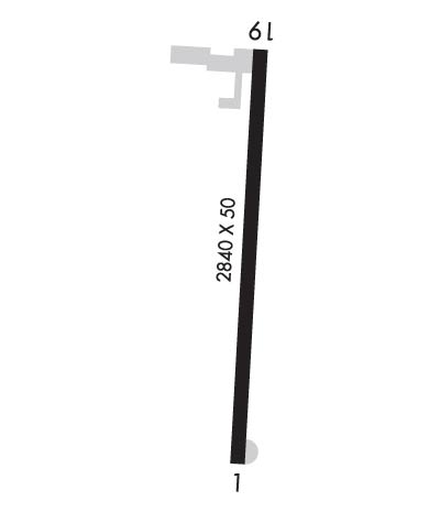
| Lat: N 4003.4 Long: W 08057.8 Elev: 1187 Var: +08 Longest Runway: 2840 | ||
| CTAF: 122.9 | ||
| ||||||||||||||||||||||||||||||||
| ||||||||||||||||||||||||||||||||
| Rwy | Rwy | |||||||
| 2840x50 | 2840' | 2840x50 | 2840' | |||||
| Runway ID | Single Wheel | Double Wheel | Double Tandem Wheel | Dual Double Wheel |
| 01/19 | N/A | N/A | N/A | N/A |
| These numbers are Advisory and are not limits. The Airport Manager should have more accurate Weight Limits | ||||
 Airport Diagram might not be current. | |
| Facility Name: | ALDERMAN |
| City Name: | ST CLAIRSVILLE |
| County: | BELMONT |
| State abbrev: | OH |
| State Name: | OHIO |
| Ownership: | PRIVATELY OWNED |
| Use: | OPEN TO THE PUBLIC |
| Owner's Name: | VIRGINIA ALDERMAN |
| Address: | 67160 ARPT RD, RT 3 |
| ST. CLAIRSVILLE, OH 43950 | |
| Owner's Phone: | 740-695-0908 |
| Manager's Name: | LESLIE ALDERMAN |
| Address: | AIRPORT RD, RT 3 |
| ST. CLAIRSVILLE, OH 43950 | |
| Phone: | 740-695-0908 |
| FAA Region: | GREAT LAKES |
| FAA Field Office: | DET |
| Date | Sunrise | Sunset |
|---|---|---|
| 09/24/21 Friday | 7:13 | 19:18 |
| 09/25/21 Saturday | 7:14 | 19:16 |
| 09/26/21 Sunday | 7:15 | 19:15 |
| 09/27/21 Monday | 7:16 | 19:13 |
| 09/28/21 Tuesday | 7:17 | 19:11 |
| 09/29/21 Wednesday | 7:18 | 19:10 |
| 09/30/21 Thursday | 7:19 | 19:08 |
| 10/01/21 Friday | 7:20 | 19:07 |
| 10/02/21 Saturday | 7:21 | 19:05 |
| 10/03/21 Sunday | 7:22 | 19:03 |
| 10/04/21 Monday | 7:23 | 19:02 |
| 10/05/21 Tuesday | 7:24 | 19:00 |
| 10/06/21 Wednesday | 7:25 | 18:58 |
| 10/07/21 Thursday | 7:26 | 18:57 |
| Airport Attendance Schedule | 7 Days A Week 0800-DUSK |
| Airport Status | OPERATIONAL (This Status can change at any time - please check NOTAMS) |
| Airport Lighting Schedule | ACTVT LIRL RWY 01/19 - 123.3 OR CALL 740-695-0908.; ACTVT BCN - 123.3 OR CALL (740) 695-0908 |
| Airport Storage Available | Tie Downs, Hanger |
| Extra Services Available | NONE |
| Wind Indicator | YES - (unlit) |
| Control Tower | NO |
| CTAF Frequency | 122.900 |
| Unicom Frequency | CTAF/MULTICOM:122.9MHZ |
| Rotating Beacon Color | CLEAR-GREEN (Light Land Airport) |
| Segmented Circle | NO |
| Landing Fee | YES |
| Airport Inspected | STATE - performed by STATE AERONAUTICAL PERSONNEL |
| Inspection Date | 09/06/2018 |
| Type of Fuel Available | None |
| Airframe Repair Service | NONE |
| Power Plant Repair Service | NONE |
| Latitude | N4003.4 |
| Longitude | W08057.8 (ESTIMATED) |
| Arpt Elevation | 1186ft (SURVEYED) |
| Magnetic Variation | 08W |
| 3 miles SW | of ST CLAIRSVILLE |
| Traffic Pattern Altitude | |
| Sectional Chart | DETROIT |
| Operations (Reported) | Yearly | Avg. Daily |
|---|---|---|
| General Aviation Transient | 1800 | 5 |
| General Aviation Local | 3850 | 11 |
| Air Taxi | 0 | 0 |
| Commerical | 0 | 0 |
| Commuter | 0 | 0 |
| Military | 800 | 2 |
| Aircraft based on Field | |
|---|---|
| General Aviation Singles | 4 |
| General Aviation Multi | 0 |
| Jet Aircraft | 0 |
| General Aviation Helicopters | 0 |
| Military Aircraft | 0 |
| Gliders | 0 |
| Ultralights | 0 |
| FSS on field | NO |
| FSS tie-in | CLEVELAND |
| FSS Phone | 1-800-WX-BRIEF |
| Who issues Notams | CLE |
| Notam D service at airport | YES |
| ARTCC Name | CLEVELAND |
| Airport Certification | |
| Aircraft Rescue & Firefighting Index | None |
| Airport of Entry | No |
| Custom Landing Rights | No |
| Joint Civil/Military | No |
| Military Landing rights | No |
| S HALF OF RAMP POOR CONDTION DUE TO BROKEN PAVEMENT |
| FOR APCH/DEP CTC CLEVELAND ARTCC AT 440-774-0226. |
| OCCL DEER, BIRDS & OTHER WILDLIFE ON & INVOF ARPT |
| FOR CD CTC CLEVELAND ARTCC AT 440-774-0226. |
| RWY 01/1 9 MKG FADED AND NON-STANDARD. |
| RWY 01/1 9 SFC IS WEATHERED W/SOME RAVELING, MED BLOCK CRACKING THROUGHOUT |
| RWY 01/1 9 15 FT FROM EDGE OF PAVEMENT. |
Airport Communications & Frequencies:
| |||||||||
| Runway: 01 | Runway: 19 | ||
| Mag heading: | 13° | Mag heading: | 193° |
| Rwy Slope: | .92% Up | Rwy Slope: | -.92% Down |
| Approach: | Approach: | ||
| Pattern: | Left Traffic | Pattern: | Left Traffic |
| Markings: | BASIC | Markings: | BASIC |
| Marking Condition: | POOR | Marking Condition: | POOR |
| Arresting Dev: | Arresting Dev: | ||
| Lat & Long: | N4003.2 W08057.8 | Lat. & Long.: | N4003.6 W08057.8 |
| Elev: | 1160.5 ft. MSL | Elev: | 1186.5 ft. MSL |
| TCH: | TCH: | ||
| Visual Glide Path: | Visual Glide Path: | ||
| Displaced Threshold: | No | Displaced Threshold: | No |
| Touchdown Zone: | YES | Touchdown Zone: | YES |
| Touchdown Elev.: | 1186.5 feet | Touchdown Elev.: | 1186.5 feet |
| Visual Glide Slope: | Visual Glide Slope: | ||
| RVR Equipment: | RVR Equipment: | ||
| RVV Equipment: | NO | RVV Equipment: | NO |
| Approach Lights: | Approach Lights: | ||
| REIL: | NO | REIL: | NO |
| Centerline Lights: | NO | Centerline Lights: | NO |
| Touchdown lights: | NO | Touchdown lights: | NO |
| Runway Category: | Runway with a Visual Approach | Runway Category: | Runway with a Visual Approach |
| Declared Distances: | Declared Distances: | ||
| Obstructions: | TREES | Obstructions: | TREES |
| Marked: | NOT Marked/Lighted | Marked: | NOT Marked/Lighted |
| Clearance slope: | 2:1 | Clearance slope: | 8:1 |
| Obstruction height: | 30 feet AGL | Obstruction height: | 10 feet AGL |
| Dist. from runway: | 275 feet | Dist. from runway: | 280 feet |
| Centerline offset: | 105 right of centerline | Centerline offset: | 110 feet right of centerline |
| Comments: | Comments: | +10 FT BARN 180 FT FM RWY END 120 FT L; +10 FT TREE 170 FT FM 125 FT R |
Thanks for using FltPlan.com
all rights reserved © 1999-2021 by Flight Plan LLC
