
| BRAWLEY MUNI BRAWLEY CA |
| |
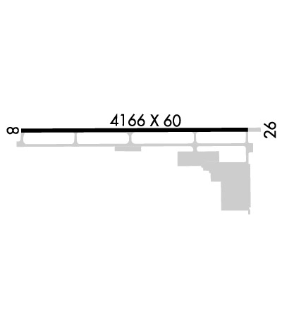
| Lat: N 3259.6 Long: W 11531.0 Elev: -128 Var: -13 Longest Runway: 4166 | ||
| CTAF: 122.9 | ||
| ||||||||||||||||||||||||||||||||||||||||||||
| ||||||||||||||||||||||||||||||||||||||||||||
| Rwy | Rwy | |||||||
| 4166x60 | 3772' | 4166x60 | 4006' | |||||
| Runway ID | Single Wheel | Double Wheel | Double Tandem Wheel | Dual Double Wheel |
| 08/26 | 20,000 | N/A | N/A | N/A |
| These numbers are Advisory and are not limits. The Airport Manager should have more accurate Weight Limits | ||||
 Airport Diagram might not be current. | |
| Facility Name: | BRAWLEY MUNI |
| City Name: | BRAWLEY |
| County: | IMPERIAL |
| State abbrev: | CA |
| State Name: | CALIFORNIA |
| Ownership: | PUBLICLY OWNED |
| Use: | OPEN TO THE PUBLIC |
| Owner's Name: | CITY OF BRAWLEY |
| Address: | 400 MAIN STREET |
| BRAWLEY, CA 92227 | |
| Owner's Phone: | 760-344-5800 |
| Manager's Name: | ALAN CHAN |
| Address: | 180 S. WESTERN AVENUE |
| BRAWLEY, CA 92227 | |
| Phone: | 760-587-4122; PUBLIC WORKS DEPT OFFICE IN BRAWLEY |
| FAA Region: | WESTERN-PACIFIC |
| FAA Field Office: | LAX |
| Date | Sunrise | Sunset |
|---|---|---|
| 02/06/25 Thursday | 6:34 | 17:19 |
| 02/07/25 Friday | 6:33 | 17:20 |
| 02/08/25 Saturday | 6:32 | 17:21 |
| 02/09/25 Sunday | 6:31 | 17:22 |
| 02/10/25 Monday | 6:30 | 17:23 |
| 02/11/25 Tuesday | 6:30 | 17:24 |
| 02/12/25 Wednesday | 6:29 | 17:25 |
| 02/13/25 Thursday | 6:28 | 17:26 |
| 02/14/25 Friday | 6:27 | 17:26 |
| 02/15/25 Saturday | 6:26 | 17:27 |
| 02/16/25 Sunday | 6:25 | 17:28 |
| 02/17/25 Monday | 6:24 | 17:29 |
| 02/18/25 Tuesday | 6:23 | 17:30 |
| 02/19/25 Wednesday | 6:22 | 17:31 |
| Airport Attendance Schedule | UNATTENDED |
| Airport Status | OPERATIONAL (This Status can change at any time - please check NOTAMS) |
| Airport Lighting Schedule | ACTVT REIL RWY 08 & 26; MIRL RWY 08/26; TWY LGTS - CTAF. |
| Airport Storage Available | Tie Downs |
| Extra Services Available | Crop Dusting, Air Ambulance, Charter, Flight Instruction, Aircraft Rental |
| Wind Indicator | YES - (lighted) |
| Control Tower | NO |
| CTAF Frequency | 122.900 |
| Unicom Frequency | |
| Rotating Beacon Color | WG |
| Segmented Circle | YES |
| Landing Fee | NO |
| Airport Inspected | STATE - performed by STATE AERONAUTICAL PERSONNEL |
| Inspection Date | 02/23/2024 |
| Type of Fuel Available | Grade 100LL, JET A; -10FOR FUEL USE CARDLOCK-24/7.; -A+AFTER HRS ON-CALL 760-353-1182. |
| Airframe Repair Service | MAJOR |
| Power Plant Repair Service | MAJOR |
| Latitude | N3259.6 |
| Longitude | W11531.0 (ESTIMATED) |
| Arpt Elevation | -128ft (SURVEYED) |
| Magnetic Variation | 13E |
| 1 miles NE | of BRAWLEY |
| Traffic Pattern Altitude | TPA 800' CONVENTIONAL ACFT; 1200 JET ACFT. |
| Sectional Chart | LOS ANGELES |
| Operations (Reported) | Yearly | Avg. Daily |
|---|---|---|
| General Aviation Transient | 0 | 0 |
| General Aviation Local | 0 | 0 |
| Air Taxi | 0 | 0 |
| Commerical | 0 | 0 |
| Commuter | 0 | 0 |
| Military | 0 | 0 |
| Aircraft based on Field | |
|---|---|
| General Aviation Singles | 0 |
| General Aviation Multi | 0 |
| Jet Aircraft | 0 |
| General Aviation Helicopters | 0 |
| Military Aircraft | 0 |
| Gliders | 0 |
| Ultralights | 0 |
| FSS on field | NO |
| FSS tie-in | SAN DIEGO |
| FSS Phone | 1-800-WX-BRIEF |
| Who issues Notams | SAN |
| Notam D service at airport | YES |
| ARTCC Name | LOS ANGELES |
| Airport Certification | |
| Aircraft Rescue & Firefighting Index | None |
| Airport of Entry | No |
| Custom Landing Rights | No |
| Joint Civil/Military | No |
| Military Landing rights | No |
| NATIONAL PLAN OF INTEGRATED AIRPORT SYSTEMS (NPIAS) |
| GRANT AGREEMENTS UNDER FAAP/ADAP/AIP |
| ASSURANCES PURSUANT TO TITLE VI, CIVIL RIGHTS ACT OF 1964 |
| FOR CD CTC YUMA CERAP AT 928-269-9569. |
Airport Communications & Frequencies:
| |||||||
| Runway: 08 | Runway: 26 | ||
| Mag heading: | 77° | Mag heading: | 257° |
| Rwy Slope: | -.11% Down | Rwy Slope: | .11% Up |
| Approach: | Approach: | ||
| Pattern: | Left Traffic | Pattern: | Right Traffic |
| Markings: | NONPRECISION INSTRUMENT | Markings: | NONPRECISION INSTRUMENT |
| Marking Condition: | GOOD | Marking Condition: | GOOD |
| Arresting Dev: | Arresting Dev: | ||
| Lat & Long: | N3259.6 W11531.4 | Lat. & Long.: | N3259.6 W11530.6 |
| Elev: | -128.1 ft. MSL | Elev: | -132.5 ft. MSL |
| TCH: | 43 ft. AGL | TCH: | 43 ft. AGL |
| Visual Glide Path: | 3.00 degrees | Visual Glide Path: | 3.00 degrees |
| Displaced Threshold: | 394 feet | Displaced Threshold: | 160 feet |
| Touchdown Zone: | YES | Touchdown Zone: | YES |
| Touchdown Elev.: | -128.2 feet | Touchdown Elev.: | -128.9 feet |
| Visual Glide Slope: | 2-Light PAPI on LEFT side of Runway | Visual Glide Slope: | 2-Light PAPI on RIGHT side of Runway |
| RVR Equipment: | RVR Equipment: | ||
| RVV Equipment: | NO | RVV Equipment: | NO |
| Approach Lights: | Approach Lights: | ||
| REIL: | YES | REIL: | YES |
| Centerline Lights: | NO | Centerline Lights: | NO |
| Touchdown lights: | NO | Touchdown lights: | NO |
| Runway Category: | Runway with a Visual Approach | Runway Category: | Runway with a Non-precision Approach |
| Declared Distances: | Declared Distances: | ||
| Obstructions: | RR | Obstructions: | |
| Marked: | NOT Marked/Lighted | Marked: | |
| Clearance slope: | RWY 08 APCH RATIO 26:1 TO DSPLCD THR. | Clearance slope: | 20:1; APCH RATIO TO DSPLCD THR +15 FT ROAD 510 FT FM DSPLCD THR 34:1. |
| Obstruction height: | 23 feet AGL | Obstruction height: | |
| Dist. from runway: | 210 feet | Dist. from runway: | |
| Centerline offset: | Centerline offset: | ||
| Comments: | RWY 08 +7 FT FENCE 170 FT FM END OF RY. | Comments: | RY 26 +15 FT ROAD 115 FT FM RY END +7 FT FENCE 66 FT FM RY END. |
Thanks for using FltPlan.com
all rights reserved © 1999-2025 by Flight Plan LLC
