| PAGE FIELD FORT MYERS FL |
| |
| Lat: N 2635.2 Long: W 08151.8 Elev: 17 Var: +03 Longest Runway: 6406 | ||
| Clr Del: 121.7 Dept. ATIS: 123.72 Arr. ATIS: 123.72 Ground: 121.7 Tower: 119.0 | ||

| |||||||||||||||||||||||||||||||||||||||||||||||||||||||||||||||||||||
| |||||||||||||||||||||||||||||||||||||||||||||||||||||||||||||||||||||
| |||||||||||||||||||||||||||||||||||||||||||||||||||||||||||||||||||||
| Rwy | Rwy | |||||||
| 6406x150 | 5947' | 110.70 - 050° | 6406x150 | 6007' | ||||
| 4910x150 | 4296' | 4910x150 | 4910' | |||||
| Runway ID | Single Wheel | Double Wheel | Double Tandem Wheel | Dual Double Wheel |
| 05/23 | 83,000 | 126,000 | N/A | N/A |
| 13/31 | 42,500 | 63,000 | N/A | N/A |
| These numbers are Advisory and are not limits. The Airport Manager should have more accurate Weight Limits | ||||
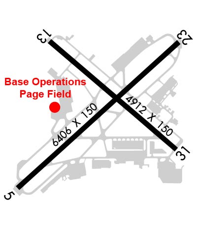 Airport Diagram might not be current. | |
| Facility Name: | PAGE FLD |
| City Name: | FORT MYERS |
| County: | LEE |
| State abbrev: | FL |
| State Name: | FLORIDA |
| Ownership: | PUBLICLY OWNED |
| Use: | OPEN TO THE PUBLIC |
| Owner's Name: | LEE COUNTY PORT AUTHORITY; CTC PERSON: BENJAMIN SIEGEL 239-590-4400 |
| Address: | 11000 TERMINAL ACCESS RD SUITE 8671 |
| FORT MYERS, FL 33913 | |
| Owner's Phone: | 239-590-4800 |
| Manager's Name: | SCOTT SHEETS; AIRPORT PHYSICAL ADDRESS: 5200 CAPT. CHANNING PAGE DRIVE. |
| Address: | 5200 CAPTAIN CHANNING PAGE DRIVE |
| FORT MYERS, FL 33907 | |
| Phone: | 239-590-6601 |
| FAA Region: | SOUTHERN |
| FAA Field Office: | ORL |
| Date | Sunrise | Sunset |
|---|---|---|
| 09/24/21 Friday | 7:17 | 19:22 |
| 09/25/21 Saturday | 7:17 | 19:21 |
| 09/26/21 Sunday | 7:18 | 19:20 |
| 09/27/21 Monday | 7:18 | 19:19 |
| 09/28/21 Tuesday | 7:18 | 19:17 |
| 09/29/21 Wednesday | 7:19 | 19:16 |
| 09/30/21 Thursday | 7:19 | 19:15 |
| 10/01/21 Friday | 7:20 | 19:14 |
| 10/02/21 Saturday | 7:20 | 19:13 |
| 10/03/21 Sunday | 7:21 | 19:12 |
| 10/04/21 Monday | 7:21 | 19:11 |
| 10/05/21 Tuesday | 7:22 | 19:10 |
| 10/06/21 Wednesday | 7:22 | 19:09 |
| 10/07/21 Thursday | 7:23 | 19:08 |
| Airport Attendance Schedule | 7 Days A Week 0600-2200 |
| Airport Status | OPERATIONAL (This Status can change at any time - please check NOTAMS) |
| Airport Lighting Schedule | WHEN ATCT CLSD, ACTVT REIL RWY 5, 13, 23, & 31; PAPI RWY 5, 13, 23, & 31; MIRL RWY 5/23 & 13/31 - CTAF. |
| Airport Storage Available | Tie Downs, Hanger |
| Extra Services Available | Air Ambulance, Avionics, Charter, Flight Instruction, Aircraft Rental, Aircraft Sales |
| Wind Indicator | YES - (lighted) |
| Control Tower | YES |
| CTAF Frequency | 119.000 |
| Unicom Frequency | AIR TO FBO COMM AVBL ON 130.55. |
| Rotating Beacon Color | CLEAR-GREEN (Light Land Airport) |
| Segmented Circle | Y-L |
| Landing Fee | YES; FEES FOR ALL CHARTER AND REVENUE PRODUCING ACFT. |
| Airport Inspected | STATE - performed by STATE AERONAUTICAL PERSONNEL |
| Inspection Date | 10/11/2018 |
| Type of Fuel Available | Grade 100LL, JET A (freeze point -40C) |
| Airframe Repair Service | MAJOR |
| Power Plant Repair Service | MAJOR |
| Latitude | N2635.2 |
| Longitude | W08151.8 (ESTIMATED) |
| Arpt Elevation | 17ft (SURVEYED) |
| Magnetic Variation | 03W |
| 3 miles S | of FORT MYERS |
| Traffic Pattern Altitude | |
| Sectional Chart | MIAMI |
| Operations (Reported) | Yearly | Avg. Daily |
|---|---|---|
| General Aviation Transient | 61052 | 167 |
| General Aviation Local | 50015 | 137 |
| Air Taxi | 3545 | 10 |
| Commerical | 9 | 0 |
| Commuter | 0 | 0 |
| Military | 242 | 1 |
| Aircraft based on Field | |
|---|---|
| General Aviation Singles | 152 |
| General Aviation Multi | 34 |
| Jet Aircraft | 14 |
| General Aviation Helicopters | 3 |
| Military Aircraft | 0 |
| Gliders | 0 |
| Ultralights | 0 |
| FSS on field | NO |
| FSS tie-in | MIAMI |
| FSS Phone | 1-800-WX-BRIEF |
| Who issues Notams | FMY |
| Notam D service at airport | YES |
| ARTCC Name | MIAMI |
| Airport Certification | |
| Aircraft Rescue & Firefighting Index | None |
| Airport of Entry | No |
| Custom Landing Rights | No |
| Joint Civil/Military | No |
| Military Landing rights | YES |
| NATIONAL PLAN OF INTEGRATED AIRPORT SYSTEMS (NPIAS) |
| GRANT AGREEMENTS UNDER FAAP/ADAP/AIP |
| SURPLUS PROPERTY AGREEMENT UNDER PUBLIC LAW 289 |
| SURPLUS PROPERTY AGREEMENT UNDER REGULATION 16-WAA |
| ASSURANCES PURSUANT TO TITLE VI, CIVIL RIGHTS ACT OF 1964 |
| AGREEMENT UNDER DLAND OR DCLA HAS EXPIRED. |
| HIGH DENSITY BIRD POPULATION WITHIN THE ARPT BOUNDARIES. |
| ACFT ON WEST RAMP CONTACT GC PRIOR TO TAXI. |
| FOR CD IF UNA TO CTC ON FSS FREQ, CTC FT MYERS APCH AT 239-768-1377, WHEN APCH CLSD CTC MIAMI ARTCC AT 305-716-1731. |
| TWY E2 BTN TWY E AND WEST RAMP CLSD TO ACFT WINGSPAN MORE THAN 79 FT. |
| WEST RAMP IS DSGND AS THE FBO RAMP. ALL OTR RAMPS ARE DSGND AS GA TENANT RAMPS. |
| BRIGHTLY LGTD BALL FIELD 1500 FT SE OF AER 05. |
| NOISE SENSITIVE AIRPORT - VOLUNTARY RESTRICTION FOR LARGE AIRCRAFT AND JET AIRCRAFT CONDUCTING MULTIPLE APPROACHES AND/OR CLOSED TRAFFIC. |
| TWY 'B' SE OF TWY 'A' IS NON-MOVEMENT AREA NOT VSB FM ATCT. |
| PAEW ADJ TO RYS & TWYS DURING DALGT HRS. |
| NO SKED COML PSGN OPNS. FOR INFO CALL AMGR 239-590-6600. |
| TAXILANE D FROM D-3 TO TWY A IS A NON-MOVEMENT AREA. |
Airport Communications & Frequencies:
| |||||||||||||||||||||||||||||||||||||
| Runway: 05 | Runway: 23 | ||
| Mag heading: | 51° | Mag heading: | 231° |
| Rwy Slope: | .07% Up | Rwy Slope: | -.07% Down |
| Approach: | ILS | Approach: | |
| Pattern: | Left Traffic | Pattern: | Left Traffic |
| Markings: | PRECISION INSTRUMENT | Markings: | PRECISION INSTRUMENT |
| Marking Condition: | GOOD | Marking Condition: | GOOD |
| Arresting Dev: | Arresting Dev: | ||
| Lat & Long: | N2634.8 W08152.3 | Lat. & Long.: | N2635.5 W08151.4 |
| Elev: | 12.8 ft. MSL | Elev: | 17.1 ft. MSL |
| TCH: | 52 ft. AGL | TCH: | 55 ft. AGL |
| Visual Glide Path: | 3.00 degrees | Visual Glide Path: | 3.00 degrees |
| Displaced Threshold: | 459 feet | Displaced Threshold: | 399 feet |
| Touchdown Zone: | YES | Touchdown Zone: | YES |
| Touchdown Elev.: | 14.6 feet | Touchdown Elev.: | 16.1 feet |
| Visual Glide Slope: | 4-Light PAPI on LEFT side of Runway | Visual Glide Slope: | 4-Light PAPI on LEFT side of Runway |
| RVR Equipment: | RVR Equipment: | ||
| RVV Equipment: | NO | RVV Equipment: | NO |
| Approach Lights: | Approach Lights: | ||
| REIL: | YES | REIL: | YES |
| Centerline Lights: | NO | Centerline Lights: | NO |
| Touchdown lights: | NO | Touchdown lights: | NO |
| Runway Category: | Precision Instrument Runway | Runway Category: | D |
| Declared Distances: | TORA:6401' TODA:6401' ASDA:6401' LDA:5947' | Declared Distances: | TORA:6401' TODA:6401' ASDA:6401' LDA:6001' |
| Obstructions: | FENCE | Obstructions: | RR |
| Marked: | NOT Marked/Lighted | Marked: | NOT Marked/Lighted |
| Clearance slope: | 1:1; RWY 05 APCH SLOPE TO DSPLCD THR 34:1 DUE TO 24 FT BLDG 345 FM END OF RWY 255 FT LEFT OF CNTRLN. | Clearance slope: | RY 23 APCH SLOPE 25:1 TO DSPLCD THLD. |
| Obstruction height: | 6 feet AGL | Obstruction height: | 23 feet AGL |
| Dist. from runway: | 185 feet | Dist. from runway: | 180 feet |
| Centerline offset: | Centerline offset: | 500 feet left of centerline | |
| Comments: | RWY 05 HAS 6 FT FENCE 185 FT FM RWY END. | Comments: | RWY 23 HAS 23 FT RR 180 FT FM END OF RWY, 500 FT LEFT OF CNTRLN. |
| Runway: 13 | Runway: 31 | ||
| Mag heading: | 133° | Mag heading: | 313° |
| Rwy Slope: | .02% Up | Rwy Slope: | -.02% Down |
| Approach: | Approach: | ||
| Pattern: | Left Traffic | Pattern: | Left Traffic |
| Markings: | NONPRECISION INSTRUMENT | Markings: | NONPRECISION INSTRUMENT |
| Marking Condition: | GOOD | Marking Condition: | GOOD |
| Arresting Dev: | Arresting Dev: | ||
| Lat & Long: | N2635.5 W08152.1 | Lat. & Long.: | N2635.0 W08151.4 |
| Elev: | 14.1 ft. MSL | Elev: | 15.0 ft. MSL |
| TCH: | 32 ft. AGL | TCH: | 41 ft. AGL |
| Visual Glide Path: | 3.00 degrees | Visual Glide Path: | 3.00 degrees |
| Displaced Threshold: | 614 feet | Displaced Threshold: | No |
| Touchdown Zone: | YES | Touchdown Zone: | YES |
| Touchdown Elev.: | 14.8 feet | Touchdown Elev.: | 15.0 feet |
| Visual Glide Slope: | 4-Light PAPI on LEFT side of Runway | Visual Glide Slope: | 4-Light PAPI on RIGHT side of Runway |
| RVR Equipment: | RVR Equipment: | ||
| RVV Equipment: | NO | RVV Equipment: | NO |
| Approach Lights: | Approach Lights: | ||
| REIL: | YES | REIL: | YES |
| Centerline Lights: | NO | Centerline Lights: | NO |
| Touchdown lights: | NO | Touchdown lights: | NO |
| Runway Category: | Runway with a Non-precision Approach having visibility minimums greater than 3/4 mile | Runway Category: | Runway with a Non-precision Approach having visibility minimums greater than 3/4 mile |
| Declared Distances: | TORA:4910' TODA:4910' ASDA:4909' LDA:4297' | Declared Distances: | TORA:4705' TODA:4910' ASDA:4667' LDA:4667' |
| Obstructions: | FENCE | Obstructions: | RR |
| Marked: | NOT Marked/Lighted | Marked: | NOT Marked/Lighted |
| Clearance slope: | 1:1; RWY 13 APCH SLOPE 47:1 TO DSPLCD THR. | Clearance slope: | 14:1 |
| Obstruction height: | 8 feet AGL | Obstruction height: | 24 feet AGL |
| Dist. from runway: | 75 feet | Dist. from runway: | 545 feet |
| Centerline offset: | Centerline offset: | 250 feet right of centerline | |
| Comments: | 15 FT BLAST FENCE & ROAD END OF RY. | Comments: |
Thanks for using FltPlan.com
all rights reserved © 1999-2021 by Flight Plan LLC