| GRANTS PASS GRANTS PASS OR |
| |
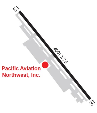
| Lat: N 4230.6 Long: W 12323.3 Elev: 1130 Var: -17 Longest Runway: 4001 | ||
| CTAF: 122.8 | ||
| |||||||||||||||||||||||||||||||
| |||||||||||||||||||||||||||||||
| Rwy | Rwy | |||||||
| 4001x75 | 4001' | 4001x75 | 4001' | |||||
| Runway ID | Single Wheel | Double Wheel | Double Tandem Wheel | Dual Double Wheel |
| 13/31 | 19,000 | N/A | N/A | N/A |
| These numbers are Advisory and are not limits. The Airport Manager should have more accurate Weight Limits | ||||
 Airport Diagram might not be current. | |
| Facility Name: | GRANTS PASS |
| City Name: | GRANTS PASS |
| County: | JOSEPHINE |
| State abbrev: | OR |
| State Name: | OREGON |
| Ownership: | PUBLICLY OWNED |
| Use: | OPEN TO THE PUBLIC |
| Owner's Name: | JOSEPHINE COUNTY AIRPORTS |
| Address: | 1441 BROOKSIDE BLVD. |
| GRANTS PASS, OR 97526 | |
| Owner's Phone: | 541-955-4535 |
| Manager's Name: | JASON DAVIS |
| Address: | 1441 BROOKSIDE BLVD. |
| GRANTS PASS, OR 97526 | |
| Phone: | 541-955-4535; FAX # - 541-479-8894 |
| FAA Region: | NORTHWEST MOUNTAIN |
| FAA Field Office: | SEA |
| Date | Sunrise | Sunset |
|---|---|---|
| 09/24/21 Friday | 7:03 | 19:08 |
| 09/25/21 Saturday | 7:04 | 19:06 |
| 09/26/21 Sunday | 7:05 | 19:04 |
| 09/27/21 Monday | 7:06 | 19:02 |
| 09/28/21 Tuesday | 7:07 | 19:00 |
| 09/29/21 Wednesday | 7:08 | 18:59 |
| 09/30/21 Thursday | 7:09 | 18:57 |
| 10/01/21 Friday | 7:11 | 18:55 |
| 10/02/21 Saturday | 7:12 | 18:53 |
| 10/03/21 Sunday | 7:13 | 18:52 |
| 10/04/21 Monday | 7:14 | 18:50 |
| 10/05/21 Tuesday | 7:15 | 18:48 |
| 10/06/21 Wednesday | 7:16 | 18:47 |
| 10/07/21 Thursday | 7:17 | 18:45 |
| Airport Attendance Schedule | 7 Days A Week 0800-1700 |
| Airport Status | OPERATIONAL (This Status can change at any time - please check NOTAMS) |
| Airport Lighting Schedule | ACTVT REIL RWY 13 & 31; MIRL RWY 13/31; PAPI RWY 31 - CTAF. |
| Airport Storage Available | Tie Downs |
| Extra Services Available | Flight Instruction, Aircraft Rental |
| Wind Indicator | YES - (lighted) |
| Control Tower | NO |
| CTAF Frequency | 122.800 |
| Unicom Frequency | 122.800; AUTOMATED UNICOM. |
| Rotating Beacon Color | CLEAR-GREEN (Light Land Airport) |
| Segmented Circle | YES |
| Landing Fee | NO |
| Airport Inspected | STATE - performed by STATE AERONAUTICAL PERSONNEL |
| Inspection Date | 03/10/2021 |
| Type of Fuel Available | Grade 100LL, JET A (freeze point -40C); -1024 HR CREDIT CARD FUEL AVBL. |
| Airframe Repair Service | MAJOR |
| Power Plant Repair Service | MAJOR |
| Latitude | N4230.6 |
| Longitude | W12323.3 (ESTIMATED) |
| Arpt Elevation | 1130ft (SURVEYED) |
| Magnetic Variation | 17E |
| 5 miles NW | of GRANTS PASS |
| Traffic Pattern Altitude | |
| Sectional Chart | KLAMATH FALLS |
| Operations (Reported) | Yearly | Avg. Daily |
|---|---|---|
| General Aviation Transient | 18000 | 49 |
| General Aviation Local | 6500 | 18 |
| Air Taxi | 400 | 1 |
| Commerical | 0 | 0 |
| Commuter | 0 | 0 |
| Military | 100 | 0 |
| Aircraft based on Field | |
|---|---|
| General Aviation Singles | 136 |
| General Aviation Multi | 18 |
| Jet Aircraft | 2 |
| General Aviation Helicopters | 2 |
| Military Aircraft | 0 |
| Gliders | 2 |
| Ultralights | 1 |
| FSS on field | NO |
| FSS tie-in | MC MINNVILLE |
| FSS Phone | 1-800-WX-BRIEF |
| Who issues Notams | MMV |
| Notam D service at airport | YES |
| ARTCC Name | SEATTLE |
| Airport Certification | |
| Aircraft Rescue & Firefighting Index | None |
| Airport of Entry | No |
| Custom Landing Rights | No |
| Joint Civil/Military | No |
| Military Landing rights | YES |
| NATIONAL PLAN OF INTEGRATED AIRPORT SYSTEMS (NPIAS) |
| GRANT AGREEMENTS UNDER FAAP/ADAP/AIP |
| ASSURANCES PURSUANT TO TITLE VI, CIVIL RIGHTS ACT OF 1964 |
| PAPI RWY 31 NOT TO BE USED FOR TURBOJET OPNS. |
| RY 31 DESIGNATED CALM WIND RY. |
| FOR CD CTC CASCADE APCH AT 541-607-4674/4675, WHEN APCH CLSD CTC SEATTLE ARTCC AT 253-351-3694. |
| WILDLIFE ON AND IN VCNTY OF ARPT. |
Airport Communications & Frequencies:
| |||||||||||||||||
| Runway: 13 | Runway: 31 | ||
| Mag heading: | 125° | Mag heading: | 305° |
| Rwy Slope: | .79% Up | Rwy Slope: | -.79% Down |
| Approach: | Approach: | ||
| Pattern: | Left Traffic | Pattern: | Left Traffic |
| Markings: | BASIC | Markings: | BASIC |
| Marking Condition: | GOOD; RY 13/31 BSC MARKINGS, PLUS AIMING POINT MARKINGS. | Marking Condition: | GOOD |
| Arresting Dev: | Arresting Dev: | ||
| Lat & Long: | N4230.9 W12323.6 | Lat. & Long.: | N4230.3 W12323.0 |
| Elev: | 1098.6 ft. MSL | Elev: | 1130.1 ft. MSL |
| TCH: | TCH: | 42 ft. AGL | |
| Visual Glide Path: | Visual Glide Path: | 4.00 degrees | |
| Displaced Threshold: | No | Displaced Threshold: | No |
| Touchdown Zone: | YES | Touchdown Zone: | YES |
| Touchdown Elev.: | 1114.8 feet | Touchdown Elev.: | 1130.1 feet |
| Visual Glide Slope: | Visual Glide Slope: | 4-Light PAPI on LEFT side of Runway; UNUSBL BYD 8 DEGS LEFT AND 5 DEGS RIGHT OF CNTRLN. | |
| RVR Equipment: | RVR Equipment: | ||
| RVV Equipment: | NO | RVV Equipment: | NO |
| Approach Lights: | Approach Lights: | ||
| REIL: | YES | REIL: | YES |
| Centerline Lights: | NO | Centerline Lights: | NO |
| Touchdown lights: | NO | Touchdown lights: | NO |
| Runway Category: | Runway with a Non-precision Approach having visibility minimums greater than 3/4 mile | Runway Category: | Runway with a Visual Approach |
| Declared Distances: | Declared Distances: | ||
| Obstructions: | TREE | Obstructions: | |
| Marked: | NOT Marked/Lighted | Marked: | |
| Clearance slope: | 21:1 | Clearance slope: | 20:1 |
| Obstruction height: | 70 feet AGL | Obstruction height: | |
| Dist. from runway: | 1670 feet | Dist. from runway: | |
| Centerline offset: | 200 left of centerline | Centerline offset: | |
| Comments: | Comments: |
Thanks for using FltPlan.com
all rights reserved © 1999-2021 by Flight Plan LLC