| RED WING RGNL RED WING MN |
| |
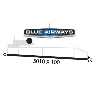
| Lat: N 4435.4 Long: W 09229.1 Elev: 778 Var: -02 Longest Runway: 5010 | ||
| AWOS: 119.25 CTAF: 123.05 | ||
| ||||||||||||||||||||||||||||||||||||||||||||||||||||||||||||||||||||
| ||||||||||||||||||||||||||||||||||||||||||||||||||||||||||||||||||||
| ||||||||||||||||||||||||||||||||||||||||||||||||||||||||||||||||||||
| ||||||||||||||||||||||||||||||||||||||||||||||||||||||||||||||||||||
| Rwy | Rwy | |||||||
| 5010x100 | 5010' | 110.10 - 091° | 5010x100 | 5010' | ||||
| Runway ID | Single Wheel | Double Wheel | Double Tandem Wheel | Dual Double Wheel |
| 09/27 | 30,000 | 75,000 | N/A | N/A |
| These numbers are Advisory and are not limits. The Airport Manager should have more accurate Weight Limits | ||||
 Airport Diagram might not be current. | |
| Facility Name: | RED WING RGNL |
| City Name: | RED WING |
| County: | PIERCE |
| State abbrev: | MN |
| State Name: | MINNESOTA |
| Ownership: | PUBLICLY OWNED |
| Use: | OPEN TO THE PUBLIC |
| Owner's Name: | CITY OF RED WING |
| Address: | PUBLIC WORKS, 229 TYLER RD N |
| RED WING, MN 55066-1826 | |
| Owner's Phone: | 651-385-3674 |
| Manager's Name: | SHAWN BLANEY |
| Address: | 229 TYLER RD N; ARPT PHYS ADS: W7145 148TH AVE, BAY CITY, WI 54723-1100. |
| RED WING, MN 55066-1826 | |
| Phone: | 651-385-3653 |
| FAA Region: | GREAT LAKES |
| FAA Field Office: | DMA |

| Date | Sunrise | Sunset |
|---|---|---|
| 04/25/25 Friday | 6:10 | 20:07 |
| 04/26/25 Saturday | 6:08 | 20:08 |
| 04/27/25 Sunday | 6:07 | 20:09 |
| 04/28/25 Monday | 6:05 | 20:11 |
| 04/29/25 Tuesday | 6:03 | 20:12 |
| 04/30/25 Wednesday | 6:02 | 20:13 |
| 05/01/25 Thursday | 6:01 | 20:14 |
| 05/02/25 Friday | 5:59 | 20:16 |
| 05/03/25 Saturday | 5:58 | 20:17 |
| 05/04/25 Sunday | 5:56 | 20:18 |
| 05/05/25 Monday | 5:55 | 20:19 |
| 05/06/25 Tuesday | 5:53 | 20:20 |
| 05/07/25 Wednesday | 5:52 | 20:22 |
| 05/08/25 Thursday | 5:51 | 20:23 |
| Airport Attendance Schedule | MON-SAT 0800-1700, SUN 1000-1600 |
| Airport Status | OPERATIONAL (This Status can change at any time - please check NOTAMS) |
| Airport Lighting Schedule | ACTVT OR INCR INTST MALSR RWY 09; ODALS RWY 27; PAPI RWY 09 & 27; HIRL RWY 09/27 - CTAF. HIRL RWY 09/27 PRESET LOW INTST. |
| Airport Storage Available | Tie Downs, Hanger |
| Extra Services Available | Avionics, Charter, Flight Instruction, Aircraft Rental, Aircraft Sales |
| Wind Indicator | YES - (lighted) |
| Control Tower | NO |
| CTAF Frequency | 123.050 |
| Unicom Frequency | 123.050 |
| Rotating Beacon Color | WG |
| Segmented Circle | YES |
| Landing Fee | NO |
| Airport Inspected | STATE - performed by STATE AERONAUTICAL PERSONNEL |
| Inspection Date | 11/10/2021 |
| Type of Fuel Available | Grade 100LL, JET A (freeze point -40C); -10FUEL AVBL H24 VIA CREDIT CARD. |
| Airframe Repair Service | MAJOR |
| Power Plant Repair Service | MAJOR |
| Latitude | N4435.4 |
| Longitude | W09229.1 (ESTIMATED) |
| Arpt Elevation | 777ft (SURVEYED) |
| Magnetic Variation | 02E |
| 3 miles NE | of RED WING |
| Traffic Pattern Altitude | |
| Sectional Chart | GREEN BAY |
| Operations (Reported) | Yearly | Avg. Daily |
|---|---|---|
| General Aviation Transient | 0 | 0 |
| General Aviation Local | 0 | 0 |
| Air Taxi | 0 | 0 |
| Commerical | 0 | 0 |
| Commuter | 0 | 0 |
| Military | 0 | 0 |
| Aircraft based on Field | |
|---|---|
| General Aviation Singles | 0 |
| General Aviation Multi | 0 |
| Jet Aircraft | 0 |
| General Aviation Helicopters | 0 |
| Military Aircraft | 0 |
| Gliders | 0 |
| Ultralights | 0 |
| FSS on field | NO |
| FSS tie-in | GREEN BAY |
| FSS Phone | 1-800-WX-BRIEF |
| Who issues Notams | RGK |
| Notam D service at airport | YES |
| ARTCC Name | MINNEAPOLIS |
| Airport Certification | |
| Aircraft Rescue & Firefighting Index | None |
| Airport of Entry | No |
| Custom Landing Rights | No |
| Joint Civil/Military | No |
| Military Landing rights | YES |
| NATIONAL PLAN OF INTEGRATED AIRPORT SYSTEMS (NPIAS) |
| GRANT AGREEMENTS UNDER FAAP/ADAP/AIP |
| ASSURANCES PURSUANT TO TITLE VI, CIVIL RIGHTS ACT OF 1964 |
| ADMIN BLDG 715-594-3701. |
| ARPT PHYS LCTN IS IN WISCONSIN. |
| DEER ON & INVOF ARPT. |
| FOR CD CTC MINNEAPOLIS APCH AT 612-726-9086. |
Airport Communications & Frequencies:
| ||||||||||||||
| Runway: 09 | Runway: 27 | ||
| Mag heading: | 91° | Mag heading: | 271° |
| Rwy Slope: | -.02% Down | Rwy Slope: | .02% Up |
| Approach: | ILS | Approach: | |
| Pattern: | Left Traffic | Pattern: | Left Traffic |
| Markings: | PRECISION INSTRUMENT | Markings: | PRECISION INSTRUMENT |
| Marking Condition: | FAIR | Marking Condition: | FAIR |
| Arresting Dev: | Arresting Dev: | ||
| Lat & Long: | N4435.4 W09229.7 | Lat. & Long.: | N4435.3 W09228.5 |
| Elev: | 777.8 ft. MSL | Elev: | 776.7 ft. MSL |
| TCH: | 50 ft. AGL | TCH: | 45 ft. AGL |
| Visual Glide Path: | 3.00 degrees | Visual Glide Path: | 3.45 degrees |
| Displaced Threshold: | No | Displaced Threshold: | No |
| Touchdown Zone: | YES | Touchdown Zone: | YES |
| Touchdown Elev.: | 777.9 feet | Touchdown Elev.: | 777.1 feet |
| Visual Glide Slope: | 4-Light PAPI on LEFT side of Runway | Visual Glide Slope: | 4-Light PAPI on LEFT side of Runway |
| RVR Equipment: | RVR Equipment: | ||
| RVV Equipment: | NO | RVV Equipment: | NO |
| Approach Lights: | MALSR - 1,400 foot medium intensity approach lighting system with runway alignment indicator lights | Approach Lights: | ODALS - omnidirectional approach lighting system |
| REIL: | NO | REIL: | NO |
| Centerline Lights: | NO | Centerline Lights: | NO |
| Touchdown lights: | NO | Touchdown lights: | NO |
| Runway Category: | Precision Instrument Runway | Runway Category: | D |
| Declared Distances: | Declared Distances: | ||
| Obstructions: | Obstructions: | TREES | |
| Marked: | Marked: | NOT Marked/Lighted | |
| Clearance slope: | 50:1 | Clearance slope: | 27:1 |
| Obstruction height: | Obstruction height: | 48 feet AGL | |
| Dist. from runway: | Dist. from runway: | 1526 feet | |
| Centerline offset: | Centerline offset: | 483 feet right of centerline | |
| Comments: | Comments: |
Thanks for using FltPlan.com
all rights reserved © 1999-2025 by Flight Plan LLC