
| UNALASKA UNALASKA AK |
| |
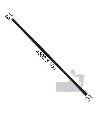
| Lat: N 5353.9 Long: W 16632.7 Elev: 23 Var: -09 Longest Runway: 4500 | ||
| AWOS: 125.80 CTAF: 122.7 | ||
| ||
| Rwy | Rwy | |||||||
| 4500x100 | 4200' | 4500x100 | 4200' | |||||
| Runway ID | Single Wheel | Double Wheel | Double Tandem Wheel | Dual Double Wheel |
| 13/31 | 60,000 | N/A | 210,000 | N/A |
| These numbers are Advisory and are not limits. The Airport Manager should have more accurate Weight Limits | ||||
 Airport Diagram might not be current. | |
| Facility Name: | UNALASKA |
| City Name: | UNALASKA |
| County: | ALEUTIANS WEST |
| State abbrev: | AK |
| State Name: | ALASKA |
| Ownership: | PUBLICLY OWNED |
| Use: | OPEN TO THE PUBLIC |
| Owner's Name: | ALASKA DOT&PF SOUTHCOAST REGION |
| Address: | PO BOX 112500 |
| JUNEAU, AK 99811-2500 | |
| Owner's Phone: | 907-465-4512 |
| Manager's Name: | DALE RUCKMAN |
| Address: | PO BOX 920525 |
| DUTCH HARBOR, AK 99692 | |
| Phone: | 907-581-1786 |
| FAA Region: | ALASKA |
| FAA Field Office: | NONE |
| Date | Sunrise | Sunset |
|---|---|---|
| 09/24/21 Friday | 8:55 | 21:00 |
| 09/25/21 Saturday | 8:57 | 20:57 |
| 09/26/21 Sunday | 8:59 | 20:55 |
| 09/27/21 Monday | 9:01 | 20:52 |
| 09/28/21 Tuesday | 9:03 | 20:50 |
| 09/29/21 Wednesday | 9:04 | 20:47 |
| 09/30/21 Thursday | 9:06 | 20:45 |
| 10/01/21 Friday | 9:08 | 20:42 |
| 10/02/21 Saturday | 9:10 | 20:40 |
| 10/03/21 Sunday | 9:12 | 20:38 |
| 10/04/21 Monday | 9:14 | 20:35 |
| 10/05/21 Tuesday | 9:15 | 20:33 |
| 10/06/21 Wednesday | 9:17 | 20:30 |
| 10/07/21 Thursday | 9:19 | 20:28 |
| Airport Attendance Schedule | 7 Days A Week 0800-1630 |
| Airport Status | OPERATIONAL (This Status can change at any time - please check NOTAMS) |
| Airport Lighting Schedule | FOR REIL RWY 13 & 31; MIRL RWY 13/31 - STOP LGT FOR VEH TFC CROSSING RWY 31 THR; KEY 122.6 - 7 TIMES FOR ON; 3 TIMES FOR STOP LGT & REIL OFF. VASI RWY 13 & 31 OPER CONTINUOUSLY. |
| Airport Storage Available | Hanger |
| Extra Services Available | Cargo Handling |
| Wind Indicator | YES - (lighted) |
| Control Tower | NO |
| CTAF Frequency | 122.600 |
| Unicom Frequency | |
| Rotating Beacon Color | CLEAR-GREEN (Light Land Airport) |
| Segmented Circle | YES |
| Landing Fee | NO |
| Airport Inspected | FEDERAL - performed by FAA AIRPORTS FIELD PERSONNEL |
| Inspection Date | 03/07/2018 |
| Type of Fuel Available | JET A (freeze point -40C) |
| Airframe Repair Service | NONE |
| Power Plant Repair Service | NONE |
| Latitude | N5353.9 |
| Longitude | W16632.7 (ESTIMATED) |
| Arpt Elevation | 23ft (SURVEYED) |
| Magnetic Variation | 09E |
| 1 miles N | of UNALASKA |
| Traffic Pattern Altitude | 2078 |
| Sectional Chart | DUTCH HARBOR |
| Operations (Reported) | Yearly | Avg. Daily |
|---|---|---|
| General Aviation Transient | 50 | 0 |
| General Aviation Local | 0 | 0 |
| Air Taxi | 100 | 0 |
| Commerical | 2500 | 7 |
| Commuter | 0 | 0 |
| Military | 50 | 0 |
| Aircraft based on Field | |
|---|---|
| General Aviation Singles | 2 |
| General Aviation Multi | 3 |
| Jet Aircraft | 0 |
| General Aviation Helicopters | 0 |
| Military Aircraft | 0 |
| Gliders | 0 |
| Ultralights | 1 |
| FSS on field | NO |
| FSS tie-in | COLD BAY; COLD BAY FSS OPRS 0800-1800, ALL OTR TIMES KENAI FSS. |
| FSS Phone | 1-800-800-478-7250 |
| Nearby FSS | KENAI |
| Phone | 1-800-866-864-1737 |
| Who issues Notams | DUT |
| Notam D service at airport | YES |
| ARTCC Name | ANCHORAGE |
| Airport Certification | AIRPORT RECEIVING SCHEDULED AIR CARRIER SERVICE FROM CARRIERS CERTIFICATED BY THE CIVIL AERONAUTICS BOARD; CLSD TO ACR OPNS WITH MORE THAN 30 PSGR SEATS EXCP PPR IN WRITING TO AMGR PO BOX 920525 DUTCH HARBOR AK 99692. |
| Aircraft Rescue & Firefighting Index | AIRPORT HAS A CERTIFICATE UNDER CFR PART 139 |
| Airport of Entry | No |
| Custom Landing Rights | No |
| Joint Civil/Military | No |
| Military Landing rights | YES |
| NATIONAL PLAN OF INTEGRATED AIRPORT SYSTEMS (NPIAS) |
| GRANT AGREEMENTS UNDER FAAP/ADAP/AIP |
| ASSURANCES PURSUANT TO TITLE VI, CIVIL RIGHTS ACT OF 1964 |
| TRANSIENT ACFT MUST PARK ON RAMP B. |
| FOR SEAPLANE GATE OPERATION KEY 122.8 - 7 TIMES TO OPEN 3 TIMES TO CLOSE; GATE CLOSES AUTOMATICALLY AFTER 5 MINUTES. SEE SECTION "C" NOTICES FOR GATE CONTROL PROCEDURE. |
| PERSONNEL AND EQUIPMENT MAY BE WORKING ON THE RWY AT ANY TIME. |
| DO NOT PERFORM LOCKED WHEEL TURNS ON RWY 13/31. |
| TRAFFIC PATTERN AROUND MOUNTAIN. |
| VASI RIGHT SIDE OF RWY SKEWED 5 DEG SOUTH OF RWY HEADING . |
| WX INFORMATION AVBL ON 129.5 (CALL SIGN DUTCH WX) OR PH: 907-581-1256, 0745-1845 HRS. |
| WX CAMERA AVBL ON INTERNET AT HTTP://AVCAMS.FAA.GOV. |
| BE ALERT: VESSEL TRAFFIC WITHIN 1500 FT FM RWY 13. VESSEL FUELING DOCK WITHIN 1300 FT FM RWY 31. |
| ARPT AREA SUBJECT TO MODERATE TO EXTREME CONCENTRATIONS OF BIRDS. |
| SNOW REMOVAL & DEICING OF RY; TWY & RAMPS ONLY PERFORMED DURING MAINTENANCE DUTY HRS. |
| ARFF EQUIP STAFFED DURG PERIODS OF LARGE AIR CARRIER OPERATIONS ONLY. |
| ARPT HAZARD REPORTING ONLY PERFORMED DURING MAINTENANCE DUTY HOURS AND FOR OVER 30 PASSENGER SEAT ACFT. |
| JET BLAST AREA AER 31 CLSD TO TAXIING ACFT EXCP WHEN ROAD VEHICLE & PEDESTRIAN TFC IS CONTROLLED BY OPERATORS REPRESENTATIVE. CLOCKWISE TURN REQUESTED. |
Airport Communications & Frequencies:
| |||||||
| Runway: 13 | Runway: 31 | ||
| Mag heading: | 127° | Mag heading: | 307° |
| Rwy Slope: | -.20% Down | Rwy Slope: | .20% Up |
| Approach: | MLS | Approach: | |
| Pattern: | Left Traffic | Pattern: | Right Traffic |
| Markings: | BASIC | Markings: | BASIC |
| Marking Condition: | GOOD | Marking Condition: | GOOD |
| Arresting Dev: | Arresting Dev: | ||
| Lat & Long: | N5354.2 W16633.1 | Lat. & Long.: | N5353.7 W16632.3 |
| Elev: | 23.3 ft. MSL | Elev: | 14.1 ft. MSL |
| TCH: | 38 ft. AGL | TCH: | 32 ft. AGL |
| Visual Glide Path: | 3.00 degrees | Visual Glide Path: | 3.00 degrees |
| Displaced Threshold: | 300 feet | Displaced Threshold: | 300 feet |
| Touchdown Zone: | YES | Touchdown Zone: | YES |
| Touchdown Elev.: | 21.7 feet | Touchdown Elev.: | 18.9 feet |
| Visual Glide Slope: | 4-BOX VASI ON LEFT SIDE OF RUNWAY | Visual Glide Slope: | 4-BOX VASI ON RIGHT SIDE OF RUNWAY; USABLE DISTANCE OF VASI 1.4 MILES DUE TO MOUNTAIN. |
| RVR Equipment: | RVR Equipment: | ||
| RVV Equipment: | NO | RVV Equipment: | NO |
| Approach Lights: | Approach Lights: | ||
| REIL: | YES | REIL: | YES |
| Centerline Lights: | NO | Centerline Lights: | NO |
| Touchdown lights: | NO | Touchdown lights: | NO |
| Runway Category: | Runway with a Visual Approach | Runway Category: | Runway with a Visual Approach |
| Declared Distances: | TORA:4500' TODA:4500' ASDA:4200' LDA:3900' | Declared Distances: | TORA:4337' TODA:4500' ASDA:4200' LDA:3900' |
| Obstructions: | BOAT | Obstructions: | BOAT |
| Marked: | NOT Marked/Lighted | Marked: | NOT Marked/Lighted |
| Clearance slope: | 14:1 | Clearance slope: | 6:1 |
| Obstruction height: | 105 feet AGL | Obstruction height: | 200 feet AGL |
| Dist. from runway: | 1500 feet | Dist. from runway: | 1220 feet |
| Centerline offset: | Centerline offset: | ||
| Comments: | Comments: |
Thanks for using FltPlan.com
all rights reserved © 1999-2021 by Flight Plan LLC