
| POTOMAC AIRFIELD FRIENDLY MD |
| |
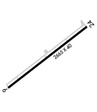
| Lat: N 3844.9 Long: W 07657.4 Elev: 118 Var: +11 Longest Runway: 2665 | ||
| CTAF: 122.8 | ||
| ||||||
|
| Rwy | Rwy | |||||||
| 2665x40 | 2289' | 2665x40 | 2575' | |||||
| Runway ID | Single Wheel | Double Wheel | Double Tandem Wheel | Dual Double Wheel |
| 06/24 | N/A | N/A | N/A | N/A |
| These numbers are Advisory and are not limits. The Airport Manager should have more accurate Weight Limits | ||||
 Airport Diagram might not be current. | |
| Facility Name: | POTOMAC AIRFIELD |
| City Name: | FRIENDLY |
| County: | PRINCE GEORGES |
| State abbrev: | MD |
| State Name: | MARYLAND |
| Ownership: | PRIVATELY OWNED |
| Use: | OPEN TO THE PUBLIC |
| Owner's Name: | COPLEY INVESTMENTS |
| Address: | 10 NEWBURY ST |
| BOSTON, MA 02116 | |
| Owner's Phone: | 617-267-6828 |
| Manager's Name: | DAVID WARTOFSKY |
| Address: | 10300 GLEN WAY |
| FORT WASHINGTON, MD 20744 | |
| Phone: | 301-248-5720 |
| FAA Region: | EASTERN |
| FAA Field Office: | DCA |
| Date | Sunrise | Sunset |
|---|---|---|
| 09/24/21 Friday | 6:57 | 19:02 |
| 09/25/21 Saturday | 6:58 | 19:00 |
| 09/26/21 Sunday | 6:59 | 18:59 |
| 09/27/21 Monday | 7:00 | 18:57 |
| 09/28/21 Tuesday | 7:01 | 18:56 |
| 09/29/21 Wednesday | 7:02 | 18:54 |
| 09/30/21 Thursday | 7:03 | 18:53 |
| 10/01/21 Friday | 7:03 | 18:51 |
| 10/02/21 Saturday | 7:04 | 18:49 |
| 10/03/21 Sunday | 7:05 | 18:48 |
| 10/04/21 Monday | 7:06 | 18:46 |
| 10/05/21 Tuesday | 7:07 | 18:45 |
| 10/06/21 Wednesday | 7:08 | 18:43 |
| 10/07/21 Thursday | 7:09 | 18:42 |
| Airport Attendance Schedule | 7 Days A Week 0700-2200 |
| Airport Status | OPERATIONAL (This Status can change at any time - please check NOTAMS) |
| Airport Lighting Schedule | MIRL RY 06/24 SS-SR; ACTVT PAPI RY 06 & 24 - CTAF |
| Airport Storage Available | Tie Downs |
| Extra Services Available | Charter, Flight Instruction, Aircraft Rental |
| Wind Indicator | YES - (lighted) |
| Control Tower | NO |
| CTAF Frequency | 122.800 |
| Unicom Frequency | 122.800; AUTOMATED UNICOM; 3 CLICKS ADZY & WX, 4 CLICKS RADIO CHECK. |
| Rotating Beacon Color | CLEAR-GREEN (Light Land Airport); ROTG BCN LOCATED 1000 FT N OF ARPT. |
| Segmented Circle | YES |
| Landing Fee | NO |
| Airport Inspected | STATE - performed by STATE AERONAUTICAL PERSONNEL |
| Inspection Date | 09/15/2020 |
| Type of Fuel Available | Grade 100LL |
| Airframe Repair Service | MAJOR |
| Power Plant Repair Service | MAJOR |
| Latitude | N3844.9 |
| Longitude | W07657.4 (ESTIMATED) |
| Arpt Elevation | 117ft (ESTIMATED) |
| Magnetic Variation | 11W |
| 0 miles NE | of FRIENDLY |
| Traffic Pattern Altitude | |
| Sectional Chart | WASHINGTON |
| Operations (Reported) | Yearly | Avg. Daily |
|---|---|---|
| General Aviation Transient | 1999 | 5 |
| General Aviation Local | 10000 | 27 |
| Air Taxi | 25 | 0 |
| Commerical | 0 | 0 |
| Commuter | 0 | 0 |
| Military | 30 | 0 |
| Aircraft based on Field | |
|---|---|
| General Aviation Singles | 91 |
| General Aviation Multi | 3 |
| Jet Aircraft | 0 |
| General Aviation Helicopters | 0 |
| Military Aircraft | 0 |
| Gliders | 0 |
| Ultralights | 0 |
| FSS on field | NO |
| FSS tie-in | LEESBURG |
| FSS Phone | 1-800-WX-BRIEF |
| Who issues Notams | DCA |
| Notam D service at airport | YES |
| ARTCC Name | WASHINGTON |
| Airport Certification | |
| Aircraft Rescue & Firefighting Index | None |
| Airport of Entry | No |
| Custom Landing Rights | No |
| Joint Civil/Military | No |
| Military Landing rights | No |
| UNLIMITED VEHICLE ACCESS TO ACFT MOVEMENT AREAS. |
| RENTALS AVABL AT 301-292-9700. |
| FOR CD CTC POTOMAC APCH AT 866-599-3874. |
| VISITORS PLEASE TUNE 122.85 FOR PARKING INSTRUCTIONS & GND SVCS. |
| NOISE ABATEMENT PROCEDURES: AVOID TAKEOFF 2200-0700. |
| EXPECT 24 HR SECURITY FROM POLICE, MILITARY & OTHERS ON THE GROUND AND IN THE AIR. |
| ARPT WITHIN FLIGHT RESTRICTED ZONE. |
Airport Communications & Frequencies:
| ||||||||||||||||||||||
| Runway: 06 | Runway: 24 | ||
| Mag heading: | 59° | Mag heading: | 239° |
| Rwy Slope: | .33% Up | Rwy Slope: | -.33% Down |
| Approach: | Approach: | ||
| Pattern: | Left Traffic | Pattern: | Right Traffic |
| Markings: | NONPRECISION INSTRUMENT | Markings: | NONSTANDARD |
| Marking Condition: | GOOD | Marking Condition: | GOOD; BASIC MKGS PLUS FIELD CARRIER LDG PRACTICE (FCLP) MKGS. |
| Arresting Dev: | Arresting Dev: | ||
| Lat & Long: | N3844.8 W07657.6 | Lat. & Long.: | N3845.1 W07657.1 |
| Elev: | 108.9 ft. MSL | Elev: | 117.7 ft. MSL |
| TCH: | 19 ft. AGL | TCH: | 20 ft. AGL |
| Visual Glide Path: | 5.00 degrees | Visual Glide Path: | 5.50 degrees |
| Displaced Threshold: | 376 feet | Displaced Threshold: | 90 feet |
| Touchdown Zone: | YES | Touchdown Zone: | YES |
| Touchdown Elev.: | 117.7 feet | Touchdown Elev.: | 117.0 feet |
| Visual Glide Slope: | 2-Light PAPI on LEFT side of Runway; RY 06 PAPI UNUSABLE 3 DEG RIGHT OF COURSE. | Visual Glide Slope: | 2-Light PAPI on LEFT side of Runway |
| RVR Equipment: | RVR Equipment: | ||
| RVV Equipment: | NO | RVV Equipment: | NO |
| Approach Lights: | Approach Lights: | ||
| REIL: | NO; REILS RYS 06 & 24 OPR SS-SR. | REIL: | NO |
| Centerline Lights: | NO | Centerline Lights: | NO |
| Touchdown lights: | NO | Touchdown lights: | NO |
| Runway Category: | Runway with a Non-precision Approach | Runway Category: | Runway with a Visual Approach |
| Declared Distances: | Declared Distances: | ||
| Obstructions: | TREES | Obstructions: | TREES |
| Marked: | NOT Marked/Lighted | Marked: | NOT Marked/Lighted |
| Clearance slope: | 8:1; APCH RATIO 20:1 AT CL TO DSPLCD THLD. | Clearance slope: | 14:1; APCH SLOPE 15:1 AT CNTRLN TO DSPLCD THLD. |
| Obstruction height: | 101 feet AGL | Obstruction height: | 77 feet AGL |
| Dist. from runway: | 1066 feet | Dist. from runway: | 1342 feet |
| Centerline offset: | 207 left of centerline | Centerline offset: | |
| Comments: | RY 06 HAS +60 FT TREES 240 FT R AT THLD. | Comments: |
Thanks for using FltPlan.com
all rights reserved © 1999-2021 by Flight Plan LLC
