
| BURLINGTON-ALAMANCE RGNL BURLINGTON NC |
| |
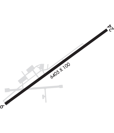
| Lat: N 3603.0 Long: W 07928.4 Elev: 616 Var: +08 Longest Runway: 6406 | ||
| Clr Del: 120.25 AWOS: 135.32 CTAF: 122.97 | ||
| |||||||||||||||||||||||||||||||||||||||||||||||||||||||||||||
| |||||||||||||||||||||||||||||||||||||||||||||||||||||||||||||
| |||||||||||||||||||||||||||||||||||||||||||||||||||||||||||||
| |||||||||||||||||||||||||||||||||||||||||||||||||||||||||||||
| |||||||||||||||||||||||||||||||||||||||||||||||||||||||||||||
| Rwy | Rwy | |||||||
| 6406x100 | 6406' | 111.35 - 060° | 6406x100 | 6406' | ||||
| Runway ID | Single Wheel | Double Wheel | Double Tandem Wheel | Dual Double Wheel |
| 06/24 | 73,000 | 97,000 | 57,000 | N/A |
| These numbers are Advisory and are not limits. The Airport Manager should have more accurate Weight Limits | ||||
 Airport Diagram might not be current. | |
| Facility Name: | BURLINGTON/ALAMANCE RGNL |
| City Name: | BURLINGTON |
| County: | ALAMANCE |
| State abbrev: | NC |
| State Name: | NORTH CAROLINA |
| Ownership: | PUBLICLY OWNED |
| Use: | OPEN TO THE PUBLIC |
| Owner's Name: | BURLINGTON-ALAMANCE AIRPORT AUTHORI |
| Address: | 3441 N. AVIATION DR. |
| BURLINGTON, NC 27215 | |
| Owner's Phone: | 336-227-0771 |
| Manager's Name: | DAN DANIELEY |
| Address: | 3441. N AVIATION DRIVE |
| BURLINGTON, NC 27215-6374 | |
| Phone: | 336-227-0771; ARPT PH# 336-226-3330. |
| FAA Region: | SOUTHERN |
| FAA Field Office: | MEM |
| Date | Sunrise | Sunset |
|---|---|---|
| 04/27/25 Sunday | 6:30 | 20:02 |
| 04/28/25 Monday | 6:29 | 20:02 |
| 04/29/25 Tuesday | 6:28 | 20:03 |
| 04/30/25 Wednesday | 6:27 | 20:04 |
| 05/01/25 Thursday | 6:26 | 20:05 |
| 05/02/25 Friday | 6:24 | 20:06 |
| 05/03/25 Saturday | 6:23 | 20:07 |
| 05/04/25 Sunday | 6:22 | 20:08 |
| 05/05/25 Monday | 6:21 | 20:08 |
| 05/06/25 Tuesday | 6:20 | 20:09 |
| 05/07/25 Wednesday | 6:19 | 20:10 |
| 05/08/25 Thursday | 6:18 | 20:11 |
| 05/09/25 Friday | 6:17 | 20:12 |
| 05/10/25 Saturday | 6:16 | 20:13 |
| Airport Attendance Schedule | 7 Days A Week 0800-2000; UNATNDD CHRISTMAS DAY. |
| Airport Status | OPERATIONAL (This Status can change at any time - please check NOTAMS) |
| Airport Lighting Schedule | ACTVT REIL RWY 06 & 24 - CTAF. PAPI RWY 06 & 24 OPER CONT. HIRL RWY 06/24 ON DUSK-DAWN, TO CHANGE INTST - CTAF. |
| Airport Storage Available | Tie Downs, Hanger |
| Extra Services Available | Air Ambulance, Charter, Flight Instruction, Aircraft Rental, Aircraft Sales |
| Wind Indicator | YES - (lighted) |
| Control Tower | NO |
| CTAF Frequency | 122.975 |
| Unicom Frequency | 122.975 |
| Rotating Beacon Color | WG |
| Segmented Circle | YES |
| Landing Fee | NO |
| Airport Inspected | STATE - performed by STATE AERONAUTICAL PERSONNEL |
| Inspection Date | 08/07/2023 |
| Type of Fuel Available | Grade 100LL, JET A-1 (icing inhibitor, freeze point -50C) |
| Airframe Repair Service | MAJOR |
| Power Plant Repair Service | MAJOR |
| Latitude | N3603.0 |
| Longitude | W07928.4 (ESTIMATED) |
| Arpt Elevation | 616ft (SURVEYED) |
| Magnetic Variation | 08W |
| 3 miles SW | of BURLINGTON |
| Traffic Pattern Altitude | |
| Sectional Chart | CINCINNATI |
| Operations (Reported) | Yearly | Avg. Daily |
|---|---|---|
| General Aviation Transient | 0 | 0 |
| General Aviation Local | 0 | 0 |
| Air Taxi | 0 | 0 |
| Commerical | 0 | 0 |
| Commuter | 0 | 0 |
| Military | 0 | 0 |
| Aircraft based on Field | |
|---|---|
| General Aviation Singles | 0 |
| General Aviation Multi | 0 |
| Jet Aircraft | 0 |
| General Aviation Helicopters | 0 |
| Military Aircraft | 0 |
| Gliders | 0 |
| Ultralights | 0 |
| FSS on field | NO |
| FSS tie-in | RALEIGH |
| FSS Phone | 1-800-WX-BRIEF |
| Who issues Notams | BUY |
| Notam D service at airport | YES |
| ARTCC Name | WASHINGTON |
| Airport Certification | |
| Aircraft Rescue & Firefighting Index | None |
| Airport of Entry | No |
| Custom Landing Rights | No |
| Joint Civil/Military | No |
| Military Landing rights | YES |
| NATIONAL PLAN OF INTEGRATED AIRPORT SYSTEMS (NPIAS) |
| GRANT AGREEMENTS UNDER FAAP/ADAP/AIP |
| ASSURANCES PURSUANT TO TITLE VI, CIVIL RIGHTS ACT OF 1964 |
| AGREEMENT UNDER DLAND OR DCLA HAS EXPIRED. |
| DEER AND WATERFOWL INVOF ARPT. |
| RWY 06, 15 FT DROP-OFF 150 FT FM THR 250 FT LEFT OF CNTRLN. |
| AFTER HRS FUEL OR EMERG ONLY 336-223-4994. |
| FOR CD CTC GREENSBORO APCH AT 743-222-6129. |
| RWY 24 HAS UNMKD HIGH VOLTAGE TRANSMISSION LINES APRXLY 4000 FT FROM THR AND BOTH SIDES OF CNTRLN. |
Airport Communications & Frequencies:
| ||||||||||||||||
| Runway: 06 | Runway: 24 | ||
| Mag heading: | 60° | Mag heading: | 240° |
| Rwy Slope: | -.46% Down | Rwy Slope: | .46% Up |
| Approach: | ILS | Approach: | |
| Pattern: | Left Traffic | Pattern: | Left Traffic |
| Markings: | PRECISION INSTRUMENT | Markings: | PRECISION INSTRUMENT |
| Marking Condition: | GOOD | Marking Condition: | GOOD |
| Arresting Dev: | Arresting Dev: | ||
| Lat & Long: | N3602.7 W07928.9 | Lat. & Long.: | N3603.3 W07927.9 |
| Elev: | 615.9 ft. MSL | Elev: | 586.7 ft. MSL |
| TCH: | 45 ft. AGL | TCH: | 59 ft. AGL |
| Visual Glide Path: | 3.00 degrees | Visual Glide Path: | 3.00 degrees |
| Displaced Threshold: | No | Displaced Threshold: | No |
| Touchdown Zone: | YES | Touchdown Zone: | YES |
| Touchdown Elev.: | 616.1 feet | Touchdown Elev.: | 597.2 feet |
| Visual Glide Slope: | 4-Light PAPI on LEFT side of Runway | Visual Glide Slope: | 4-Light PAPI on LEFT side of Runway |
| RVR Equipment: | RVR Equipment: | ||
| RVV Equipment: | NO | RVV Equipment: | NO |
| Approach Lights: | Approach Lights: | ||
| REIL: | YES | REIL: | YES |
| Centerline Lights: | NO | Centerline Lights: | NO |
| Touchdown lights: | NO | Touchdown lights: | NO |
| Runway Category: | Precision Instrument Runway | Runway Category: | Runway with a Non-precision Approach having visibility minimums greater than 3/4 mile |
| Declared Distances: | Declared Distances: | ||
| Obstructions: | TREES | Obstructions: | TREES |
| Marked: | NOT Marked/Lighted | Marked: | NOT Marked/Lighted |
| Clearance slope: | 25:1 | Clearance slope: | 25:1 |
| Obstruction height: | 38 feet AGL | Obstruction height: | 51 feet AGL |
| Dist. from runway: | 1161 feet | Dist. from runway: | 1505 feet |
| Centerline offset: | 450 left of centerline | Centerline offset: | 596 feet left of centerline |
| Comments: | 16 FT TREES 116 FT FM END OF RWY OFFSET 363 FT RIGHT OF CNTRLN. | Comments: |
Thanks for using FltPlan.com
all rights reserved © 1999-2025 by Flight Plan LLC

